Hike South Africa – 3 Dream Hikes
Updated on
- Pleasure hiking on the slopes of Table Mountain
- Coastal walks at their most beautiful
- Spectacular coastal hike on the Garden Route
While winter has the Northern Hemisphere in its grip, South Africa is heaven for hikers. The country has various beautiful hiking destinations such as the Drakensberg in the interior. However, as a fan of coastal walks, I prefer a vista of one of the two oceans that converge on the Cape. For instance, a hike on the Garden Route National Park offers a view of the Indian Ocean, or one on famous Table Mountain looks out over both the Indian and Atlantic Oceans.
In this article, we’ll be showing you three hiking options to suit all tastes. There’s an easy half-day hike on Table Mountain and two hikes with difficult degrees of difficulty along the southern coast. Have fun hiking in South Africa.
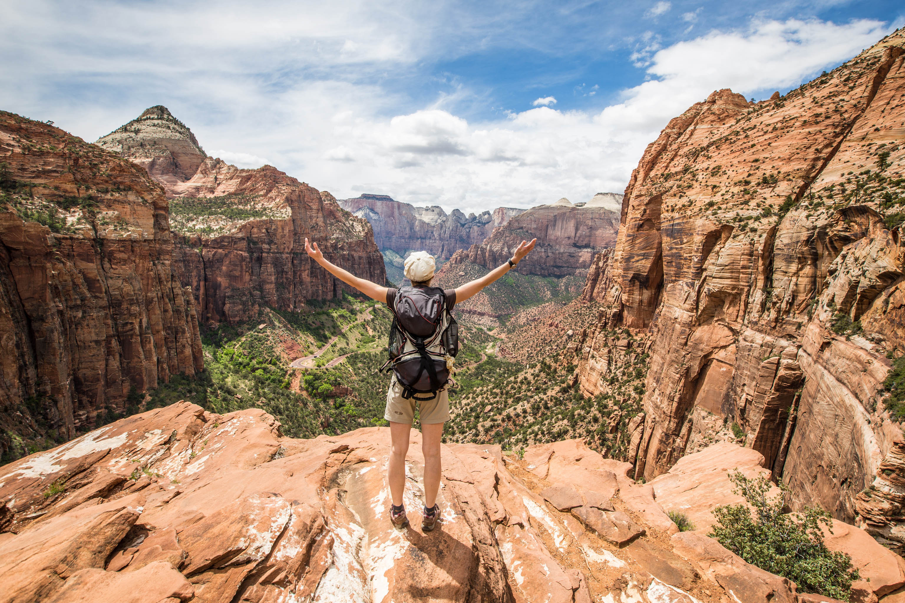
1. Pleasure hiking on the slopes of Table Mountain
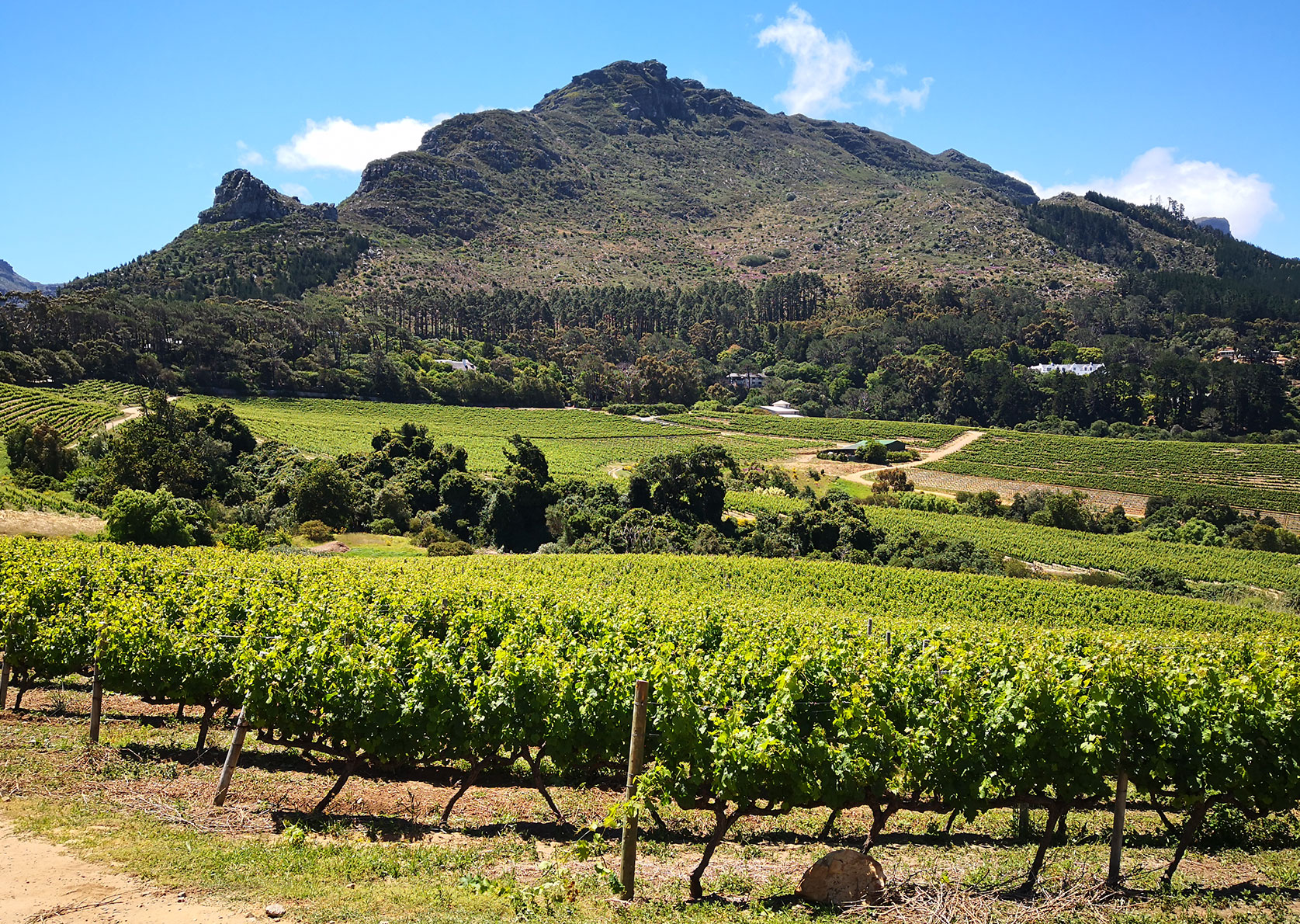
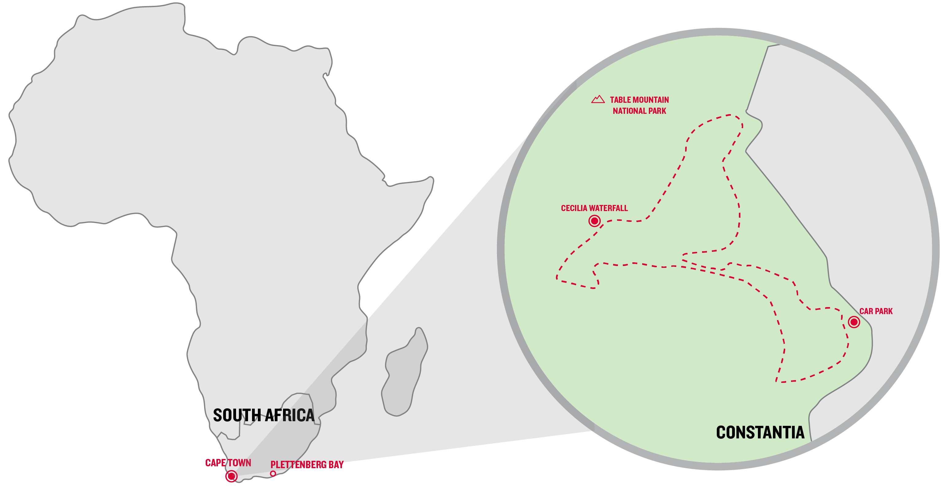
There are lots of ways to reach the famous Table Mountain, Cape Town’s landmark. The quickest route is a steep and somewhat dull one-and-a-half-hour walk from the Oranjezicht neighbourhood through Platteklip Gorge to the top. Otherwise, there’s the approximately six-hour crossing of the whole of the Table Mountain range from Constantia Nek. Constantia is a town known for its wine to the south of Table Mountain. And that’s exactly where numerous short trails for true hiking aficionados start.
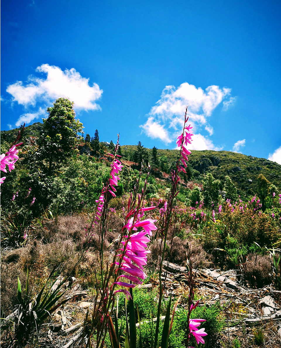
For example, there’s the roughly two-hour round trip to Cecilia Waterfall through the forest of the same name on the south-eastern slopes of Table Mountain. Typical Fynbos – South African Maquis shrubland – is interspersed with shady trees. Halfway up, there’s a magnificent view of Cape Town’s outskirts all the way to the vastness of False Bay in the Indian Ocean
Lots of streams flow down from Table Mountain to the valley in Cecilia Forest, especially after rainfall. One of them tumbles down for eight metres over moss-covered rocky ledges and tree trunks at Cecilia Waterfall. In contrast to Table Mountain, there are very few tourists here. It tends to be locals who follow the many trails for a relaxed walk on the cooler slopes.
Trail description
The trails through Cecilia Forest are very diverse, ranging from short stretches on a jeep track to narrow, winding climbs. Walkers need to be surefooted on the many wooden steps, particularly when it’s wet. Sometimes the routes take you through bushy slopes with fabulous views or through pleasantly shady dense forest.
The itinerary
Unfortunately, the trail to Cecilia Waterfall isn’t marked everywhere. And Cecilia Forest’s labyrinthine paths make finding the right turning tricky at times. We recommend you use a trail app and GPS. The AllTrails portal has a good description and map of this round trip to Cecilia Waterfall.
-
Facts and figures about the Cecilia Waterfall trail
Length: approx. 4.3 km
Duration: approx. 2 hours
Difficulty: easy to medium
Starting point: Cecilia Forest car park in Constantia (location in Google Maps) -
Our après-hike tip
Buitenverwachting is my favourite vineyard in Constantia. This place is steeped in history and offers a restaurant and wine tasting. Enjoy a picnic platter on the patio, or a glass of white wine on the shady lawn for a touch of la dolce vita South African style. Click here for the website
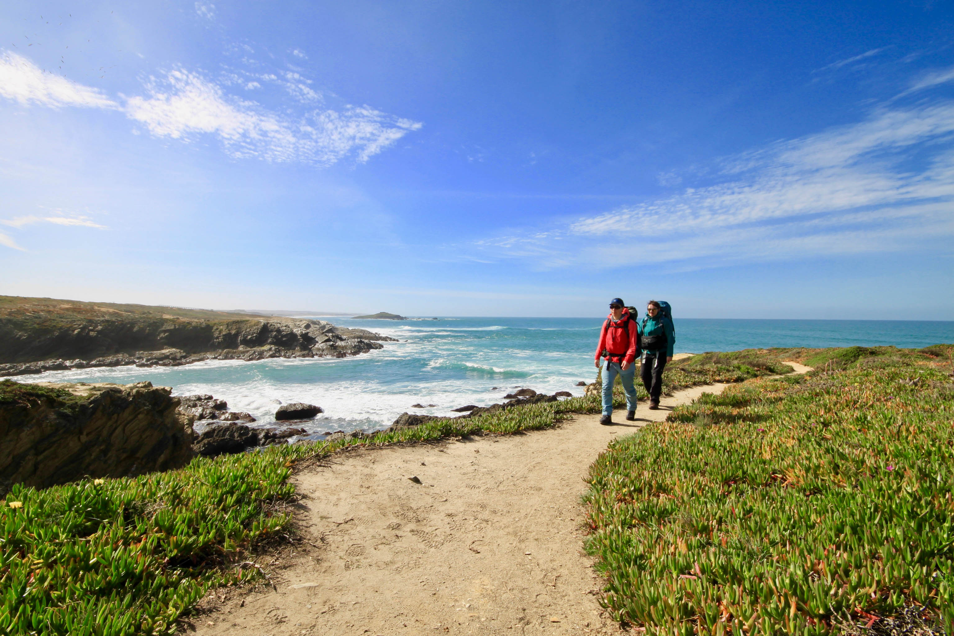
2. Coastal walks at their most beautiful
The 370-kilometre-long Garden Route is located on South Africa’s southern coast. The Garden Route is the name for the exceptionally verdant and idyllic section of coast between the towns of Mossel Bay and Port Elisabeth. The mild climate makes the Garden Route a popular summer destination. Lots of wealthy South Africans have holiday homes here. But, of course, it’s also the fantastic hiking options that attract a lot of international guests as well.
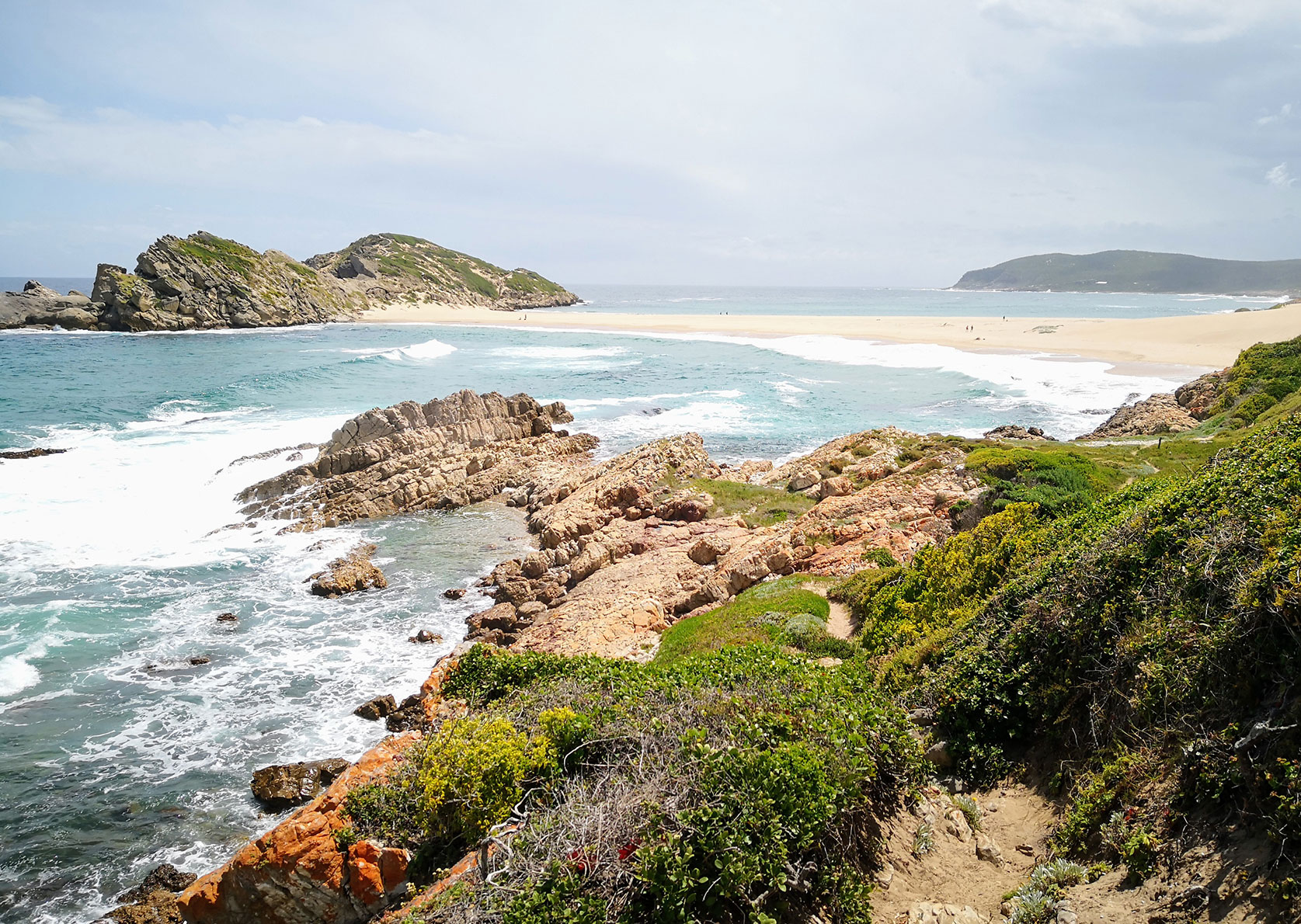
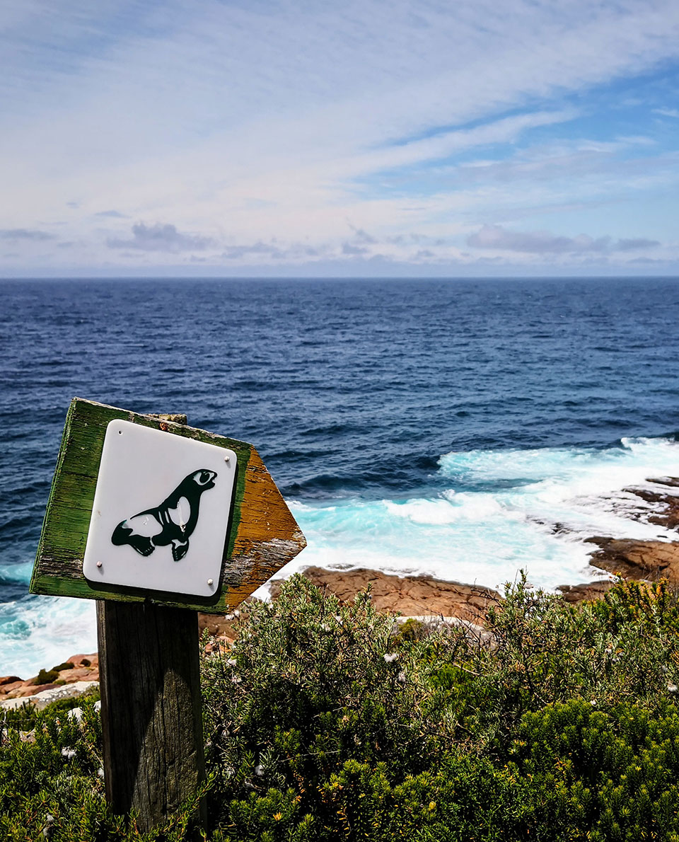
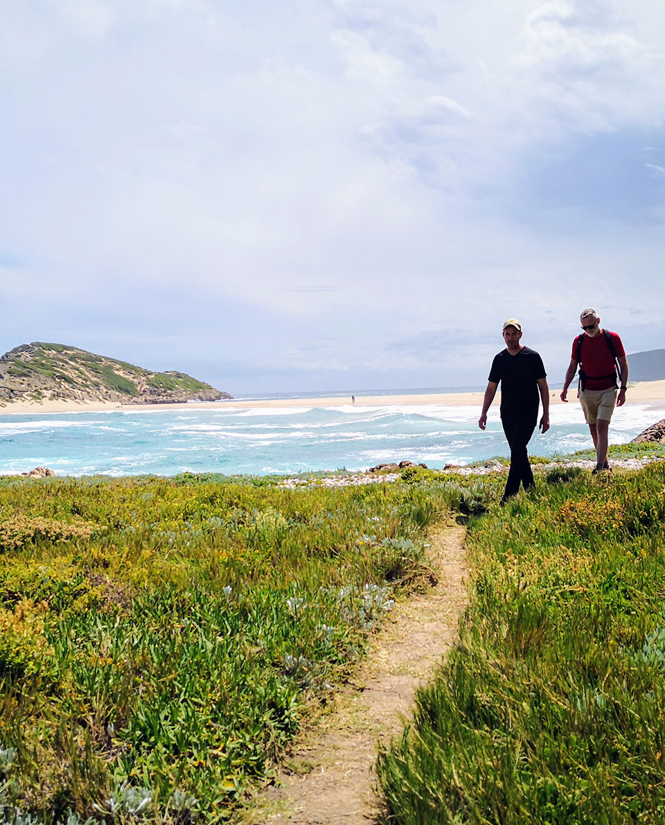
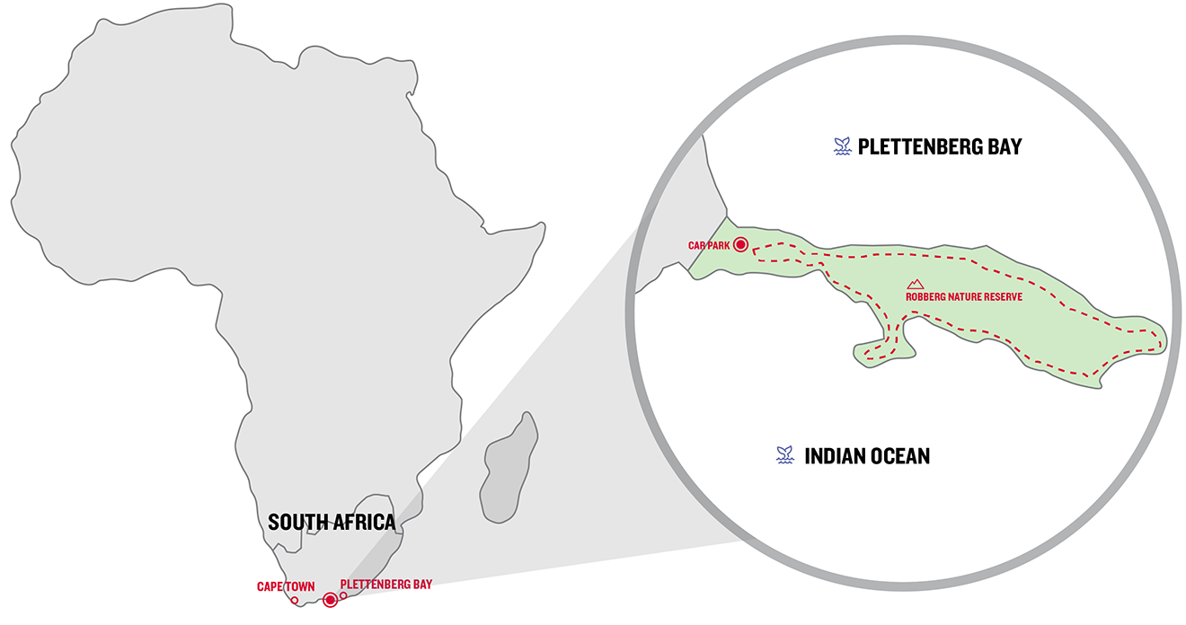
About halfway, a peninsula, the Robberg Nature Reserve, extends into the Indian Ocean. The reserve owes its name to the Dutch words for seal and mountain because a huge colony of the animals live at the foot of the 150-metre-high coastal mountain. A picture of a seal also marks the nine-kilometre-long hiking trail that goes all the way round the peninsula. You can’t miss seeing, hearing or (unfortunately) smelling the creatures either.
Trail description
The circular trail around Robberg is mostly well-trodden. On the southern side, the route often leads over cliffs or sometimes rocky bays. When the tide’s in or waves are very high, the water can come dangerously close to the hiking trail. But, overall, the trail is easy to negotiate. On the steep northern coast, a head for heights is useful.
The itinerary
All visitors have to pay 50 rand (approx. 3 euros) at the entrance to the nature reserve. The trail branches off from the car park to the northern side of the peninsula. A well-trodden path leads higher and higher up the cliff and steeply downwards at the end of the headland right close to the surf.
On the southern side, the route alternates between cliffs and paths on the slope to a sandy beach that connects Robberg with a small rocky island. The red-tinted rocks, the white surf and (ideally) steel-blue sky mean coastal walks hiking at its best. After taking a breather on the sandy beach, the path leads back up the hill and ultimately to the car park.
-
Robberg facts and figures
Length: approx. 9 km
Duration: approx. 3.5 hours
Difficulty: easy to medium
Starting point: Robberg Nature Reserve car park (The location on Google Maps) -
Our après-hike tip
There are lots of excellent restaurants in the area around Plettenberg Bay. My tip: Emily’s Restaurant with a spectacular view of Bitou River – an African panorama. Click here for the website
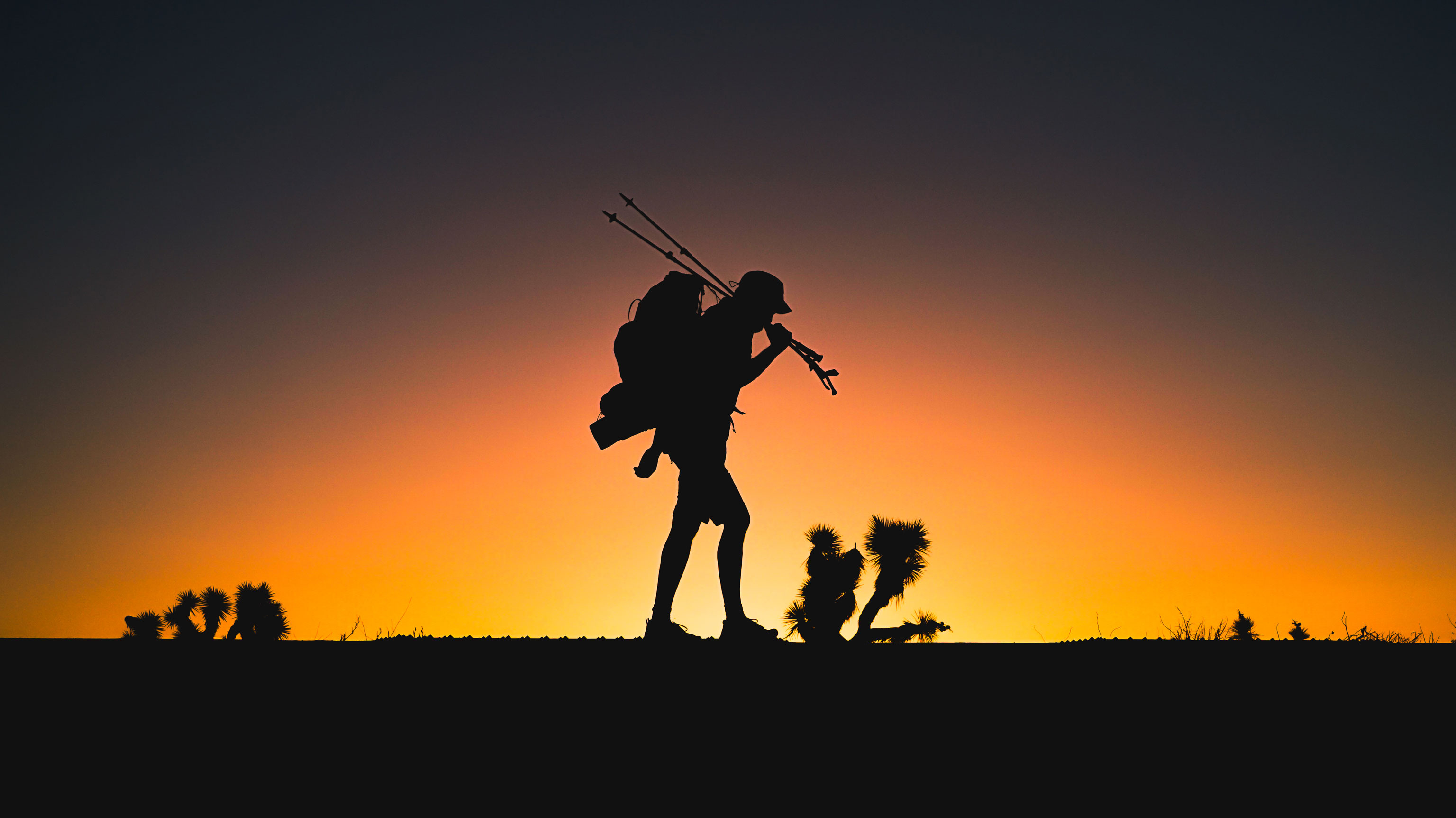
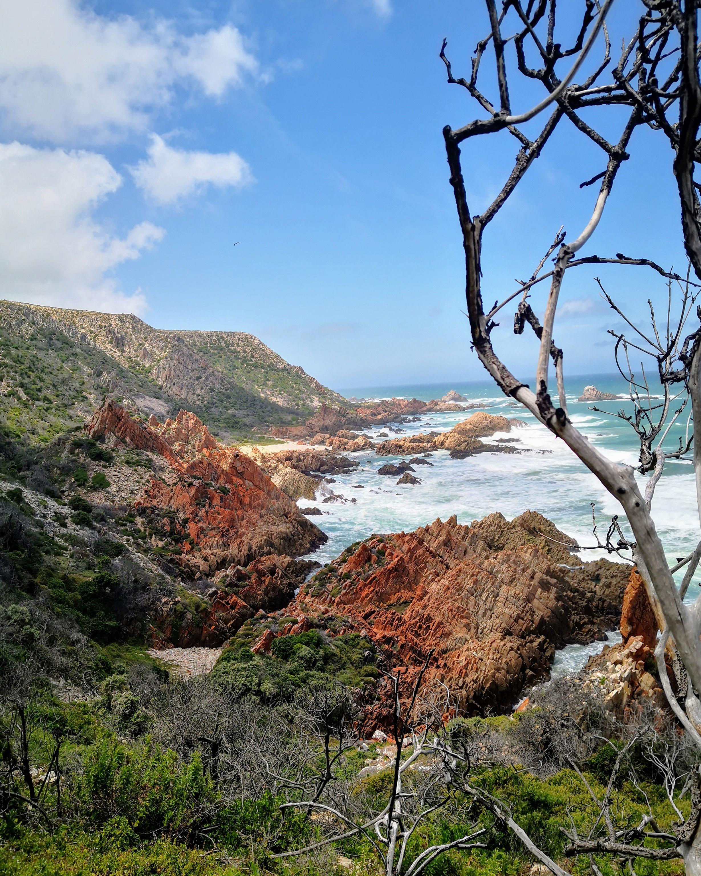
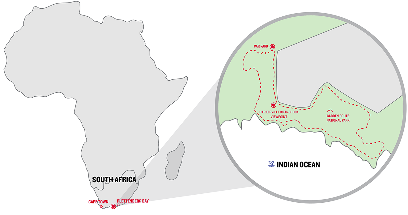
3. Spectacular coastal hike on the Garden Route
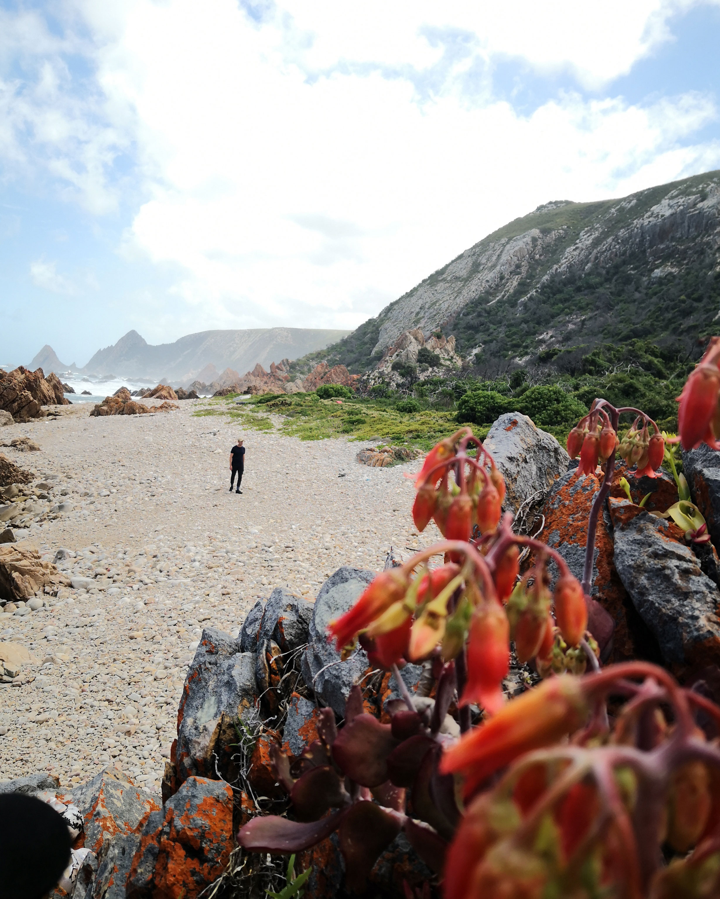
While you’re sure not to be alone for long on Table Mountain or Robberg, the Kranshoek coastal trail is still an insider tip. Only a few people embark on this coastal trail because it’s much more demanding than the other two. But the experience of nature all around is all the more spectacular.
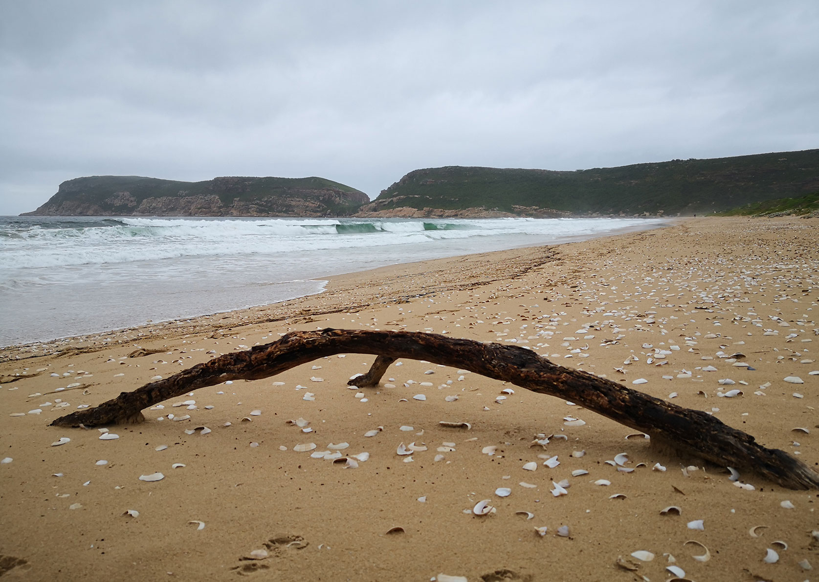
Only a narrow strip of land lies between the approx. 150-metre-high mainland cliff and the surf zone’s jagged rocks, which the sea pummels relentlessly. Against this backdrop, hikers can feel very, very small. Especially if you start the trek after a storm, as we did, and the waves are still crashing back and forth.
This is a hard-going trail that sometimes requires brief periods of scrambling over and trying to keep your balance on loose rocks. So please don’t underestimate it. Afterwards, we were exhausted, but very impressed by our outdoor experience. A coastal walk on the wild side.
Trail description
The initial descent through the forest is only slippery sometimes when it’s wet. By the sea, you walk along a trail, over stones or sometimes clamber over a rocky ledge. Very challenging are the approximately 500 metres from kilometre 2.7, where the trail gives way to steep slopes. Here you sometimes battle your way through the bushes or try to keep your balance on large rocks on a scree slope. Afterwards, the trail gets easier again. The 150-metre ascent back to the plateau is not difficult to walk.
The itinerary
From the car park, the trail descends into a densely overgrown and shady gorge. You follow the stream until it flows into the sea. There, you take a sharp left and walk along the coast until you reach a path that leads back up to the coastal ridge. From there, a path with beautiful views takes you high above the sea. The last two kilometres back to the car park are a bit monotonous though.
You can shorten the tour by climbing back up the hill at kilometre 2.1. However, you then miss most of the impressive coastal path.
.
-
Kranshoek coastal trail facts and figures
Length: approx. 9.5 km
Duration: approx. 4 hours
Difficulty: hard
Starting point: Kranshoek picnic site just in front of the Harkerville Kranshoek viewpoint (The viewpoint in Google Maps). A permit (approx. €10 per person) needs to be purchased at the barrier on entry. -
Our après-hike tip
If you discovered your passion for demanding coastal walks on the Garden Route, a five-day hike on the Otter Trail is a must. You stay in four different, small self-catering huts along the way. Because their capacity is limited, only 12 people can embark on the trail per day. Which explains why you wait a long time for a permit. Click here for the website
-
Gear for hiking in South Africa
The South African climate differs significantly from region to region. It has everything, from hot and dry deserts to rainy coastal regions. The gear you take depends on your plans.
We recommend the following items for the three trips described:
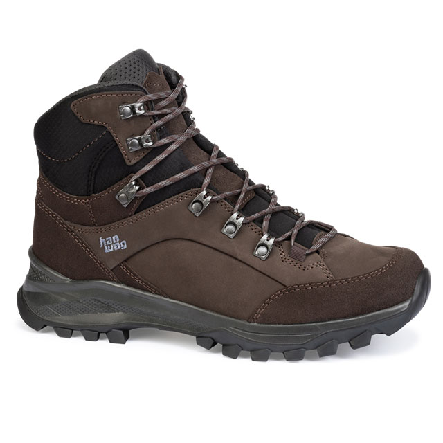
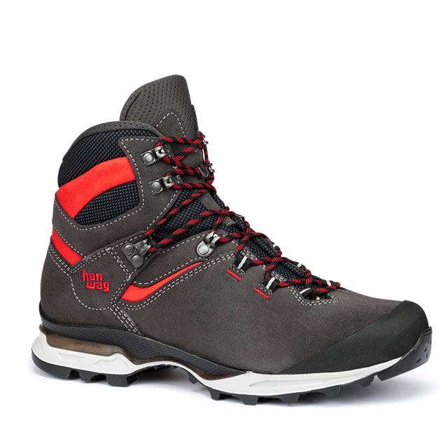
- Category A/B or B Trek Light boots. A medium high upper stops you from twisting your ankle and protects against snake bites. Boots with a low upper are only an option for surefooted hikers on well-maintained trails, such as the Cecilia Waterfall one.
- It can even sometimes rain during the South African summer (November until February), particularly along the Garden Route, which has lots of precipitation. Nevertheless, we wouldn’t recommend a boot with a waterproof membrane in this case, but one with a leather lining. They keep you dry enough for daytime hikes and score top marks for a very pleasant foot climate in the frequently high temperatures. (–> Find out more: 5 reasons for hiking boots made of leather)
- The weather on the South African coast can change very quickly, and it’s often very windy, particularly on Table Mountain. Which is why you should stash a windproof and waterproof jacket in your backpack for any daytime hike. Thin merino underwear offers the best body climate on dry, hot, or wet days. It can also be worn several times because it doesn’t get smelly that quickly.
- In summer, the sun’s rays are very strong and often accompanied by a cloudless sky. Which is why you should pick a sunblock for South Africa treks. In addition to applying an SFP 50 sunscreen, we recommend wearing a cap to protect your neck during these hikes.
-
Safety info when hiking in South Africa
Safety always plays a role on South Africa treks. Primarily, we’re referring to the high rate of crime in urban areas. But you should watch out for hazards on trails too. Above all, these include:
- … natural dangers such as snakes. There are lots of poisonous species throughout the country. The likelihood of being bitten is very low because snakes are timid and usually beat a hasty retreat. Nevertheless, keep a close eye on the path, wear footwear with high uppers, especially in grassland, and avoid the creatures’ typical hideaways such as gaps in rocks or tree stumps.
- Wild monkeys can also pose a problem if they’re aggressive. You should never tempt them with food. However, in the wild, most monkeys usually avoid people.
- Crime is a serious problem. Unfortunately, joggers, walkers or hikers are occasionally mugged. But the risk isn’t the same everywhere. Sometimes an area might experience a glut of robberies, only for them to tail off again subsequently. The trips we’ve described here are generally considered to be safe. However, the situation can always change, especially close to urban areas like Cape Town. Before setting out, ask the locals for their opinion.

Ingo Wilhelm
You’ll find him hiking, mountain biking or ski touring. Mainly in the Alps. Favourite destination: Iceland.