The top 12 long-distance walks in the world
Updated on
- Alpine Traverse Munich to Venice
- Dolomites Alta Via 1
- Tour du Mont Blanc
- Bohusleden
- Kungsleden
- Pembrokeshire Coast Path
- Te Araroa Trail
- Annapurna Circuit
- Snowman Trek
- Pacific Crest Trail
- Appalachian Trail
- Huella Andina Trail
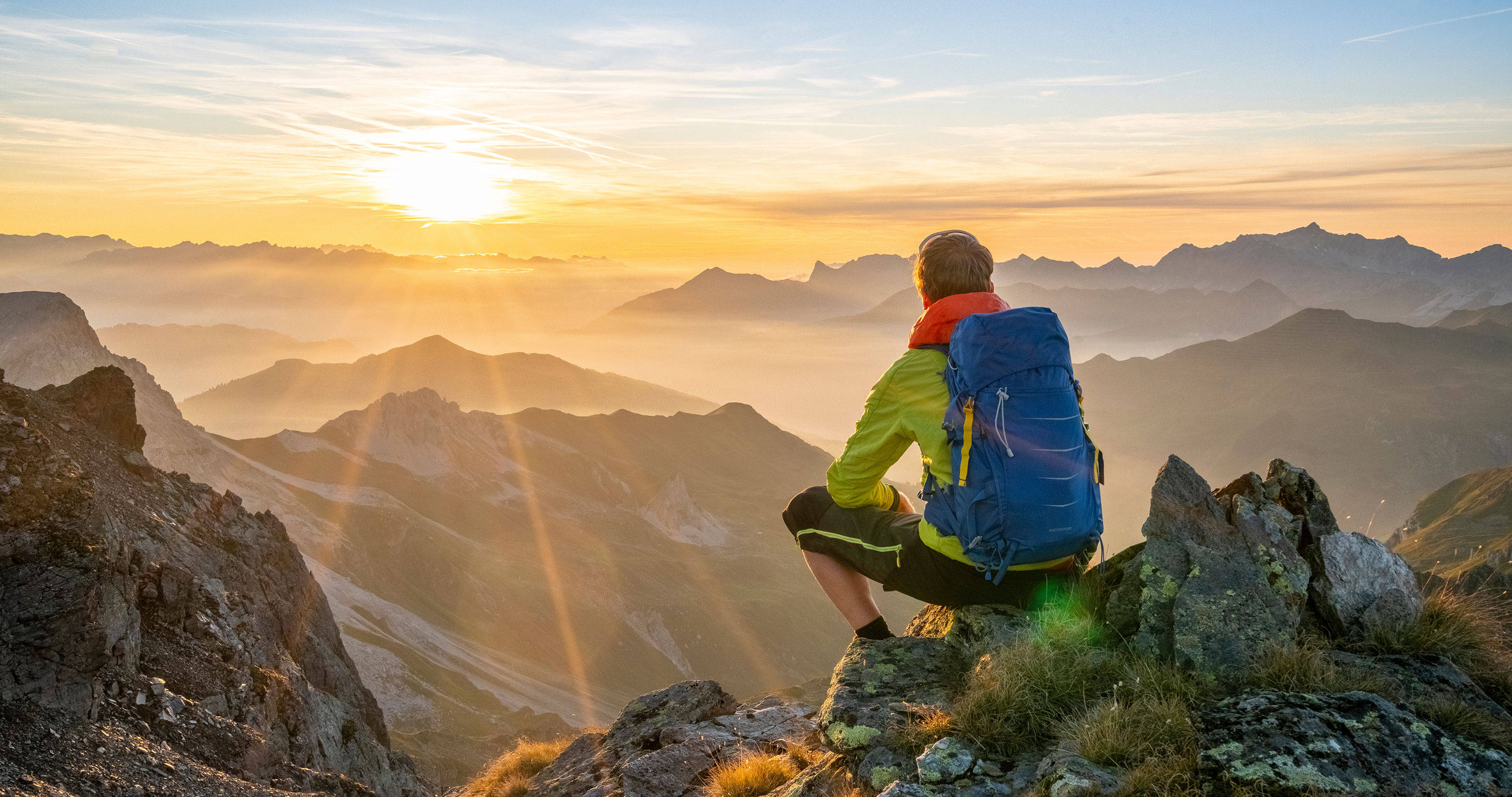
Thru-hiking routes, long-distance trails, long-distance trekking – it goes by many names, and the variety of long-distance hiking routes available worldwide is even greater. Here, we’ve compiled twelve long-distance hiking classics – a bucket list that will last a lifetime.
Whether it’s traversing the European Alps or undertaking an epic trek along the Kungsleden Trail in Sweden’s Arctic Circle, walking a coastal path in Wales, or on a long-distance trail in Germany, staying overnight in comfortable hotels, or even taking a full six months to complete the famous Pacific Crest Trail in America with just a tent and backpack – taking time out and simply going hiking is an unforgettable outdoor experience.
The length and difficulty can vary greatly between routes. From a two-week hike in the Alps, to a South American project that spans several years, and everything in between. There’s something for everyone, depending on time constraints, fitness levels or experience. Here are a dozen long-distance trails in Europe and the rest of the World you should know about – or maybe you’ve already got plans to complete one of them soon, or even just one or two sections.
Further reading on thru hiking:
–> The appeal of long-distance hiking
–> Long-distance hiking trails: 14 insider tips
–> First thru hike – tips from a pro
–> Interview with a long-distance hiking expert
–> Getting ready for a thru hike
–> 10 stunning thru-hiking facts
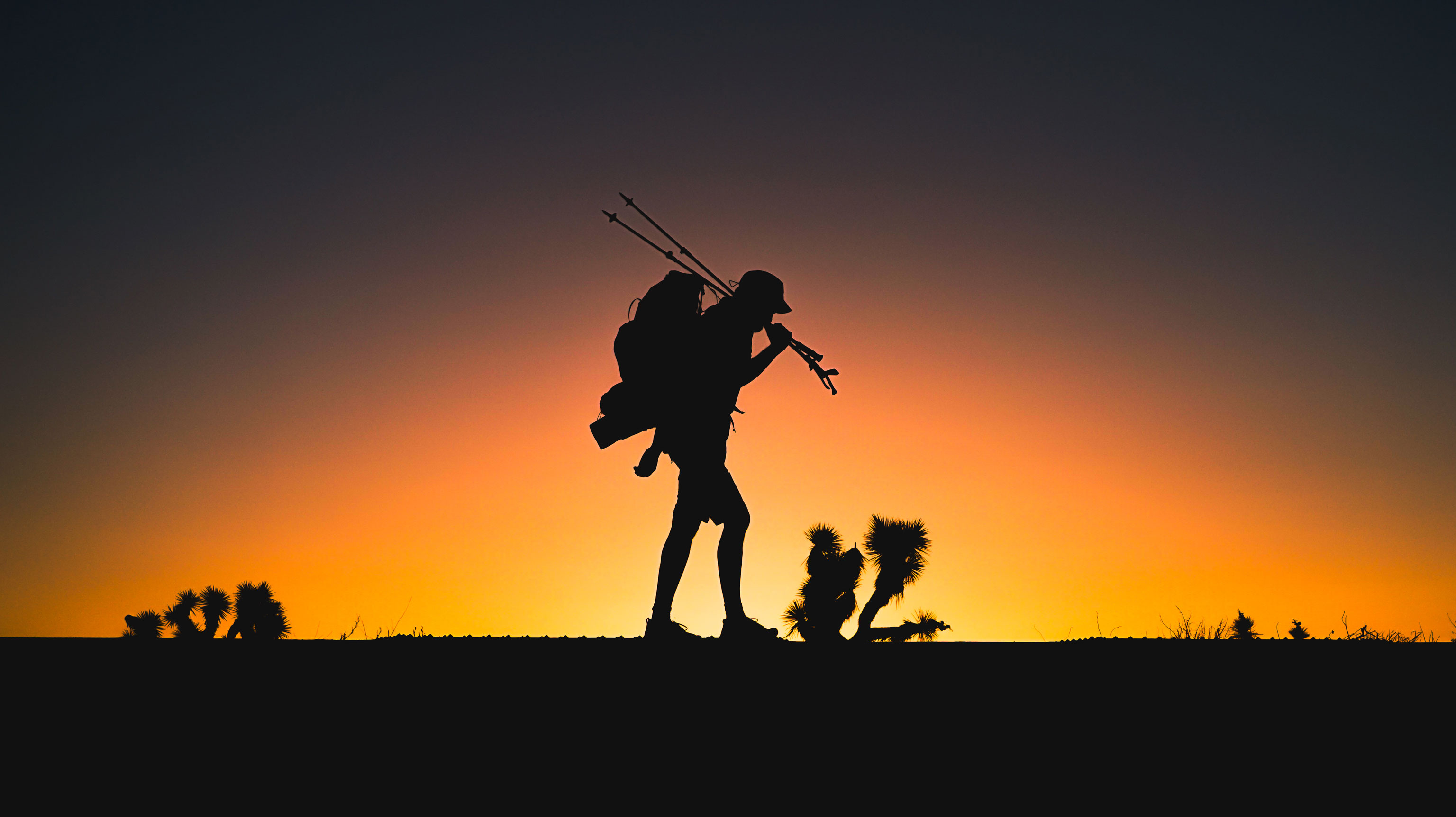
1 Alpine Traverse Munich to Venice
It’s a dream for many, and a must for any ambitious mountain hiker – the long-distance hiking trail across the entire Alps to the Mediterranean. Even Ötzi was on his way across the main ridge of the Alps, later he was followed by mule drivers on winding trade routes. And Goethe set out more than 200 years ago to cross the great mountain range on his journey to Venice. This European long-distance trail, which is split into 30 day-stages, with numerous variations, is one of the best and most desirable routes in the Alps.
Some of the highlights on the route from Munich to the Adriatic include the imposing limestone cliffs of the Karwendel range, the Tuxer Alps with breathtaking views of glaciers, and the unusual rock formations of the Dolomites. Crossing the Alps on foot offers more than its fair share of unforgettable mountain panoramas.
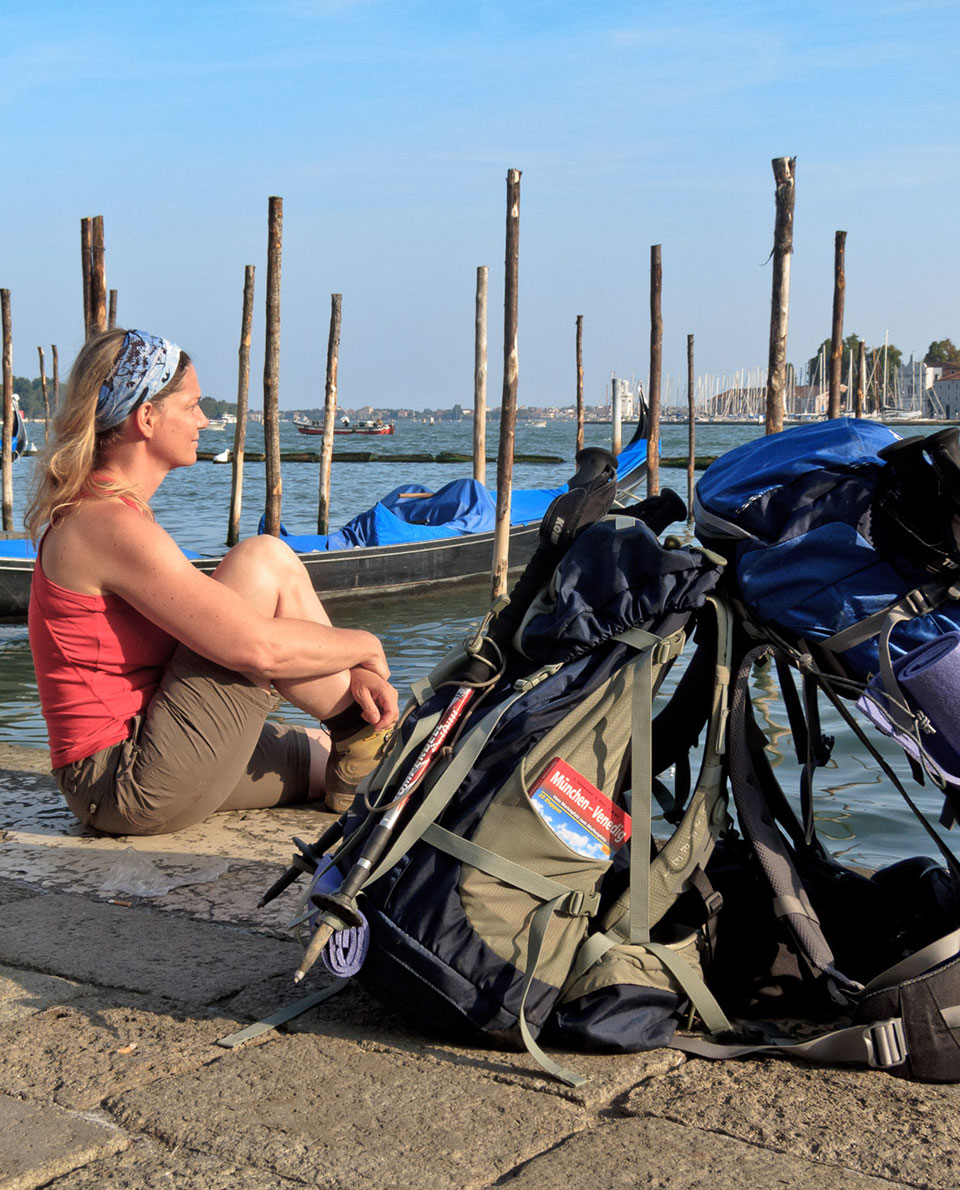
The route leads along well-maintained, marked mountain trails. Should completing the whole long-distance trail be too much or too time-consuming for hikers, it can be split into several one-week sections or hiking stages. As Goethe said: “You have only been to a place, if you went there by foot”.
Tour Profile Alpine Traverse Munich to Venice
Data & Terrain
Skills & Info
Grading
Recommended Footwear
Countries: Germany, Austria, Italy
Length: 550 km
Vertical metres: 22,000
Stages: approx. 30 day-stages
Duration: approx. 1 month
Terrain: predominantly high-alpine terrain
Suitable for: Hikers with a good level of fitness and mountaineering experience
Accommodation: Mountain huts, guesthouses, hotels. Wild camping is not permitted, only emergency bivouacking.
Personal requirements: Alpine hiking experience, surefootedness, good fitness levels
Navigation ability: Good map-reading skills. Good skills operating GPS device (optional)
Info: muenchen-venezia.info
Reading: Trekking Munich to Venice, Cicerone Press; Walking over the Alps, Munich Venice / The Cinema Film

Further reading: 5 alpine crossings for each type of hiker
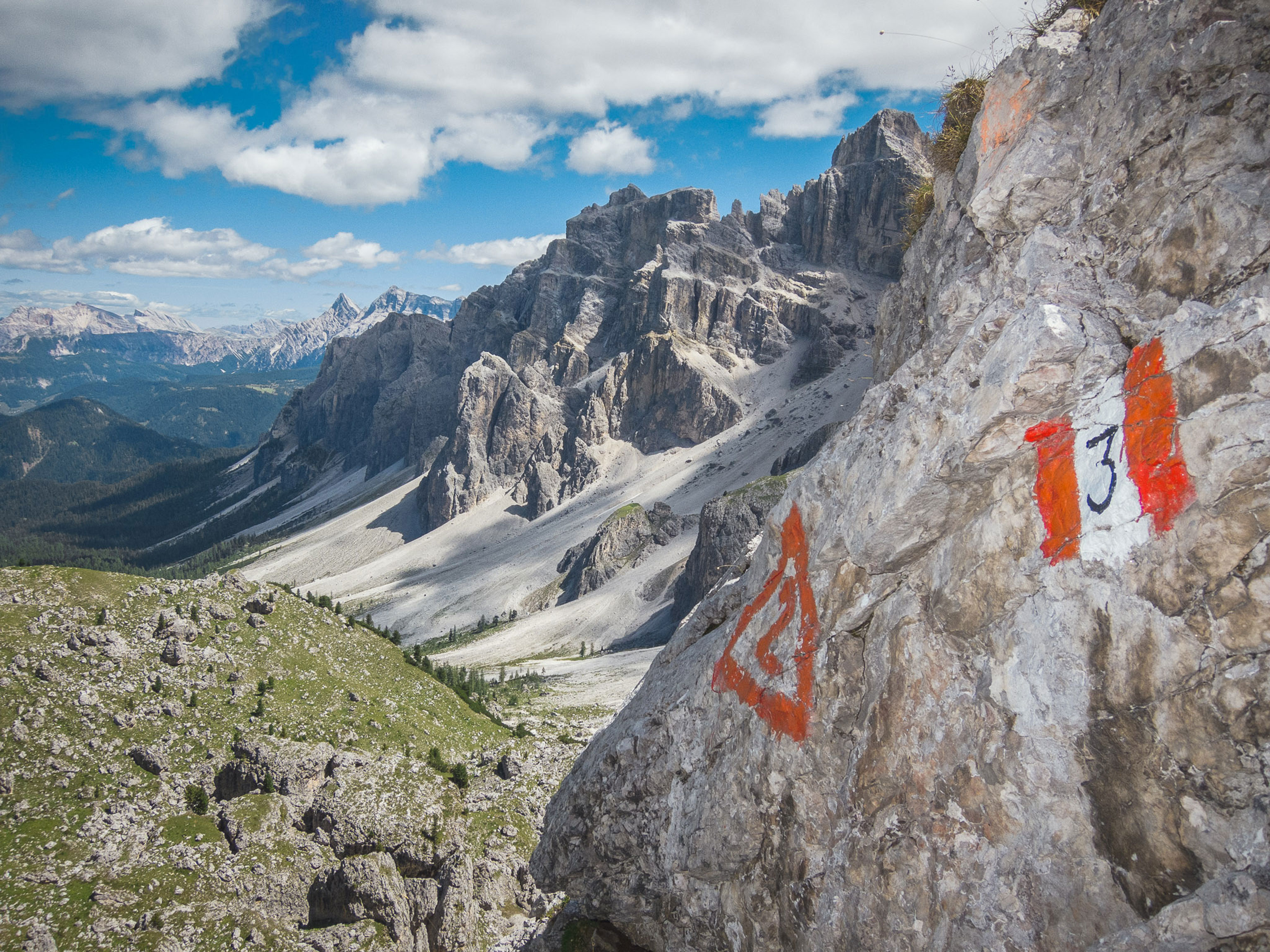
2 Dolomites Alta Via 1
The classic long-distance trek in the Southern Alps is a great alternative to the Alpine Traverse and is much more than a multi-day thru hike. Lush green alpine meadows, crowned by spectacular castles of rock and cathedrals of stone – the Dolomites’ charm lies in contrast. This is where Cliffhanger was filmed. And it’s also where Luis Trenker invented the ‘Bergfilm’, or mountain film genre. The long-distance hike on the Dolomites Alta Via 1 is just as rich in scenic and cultural highlights. The trail has run through the heart of the eastern Dolomites for over 50 years.
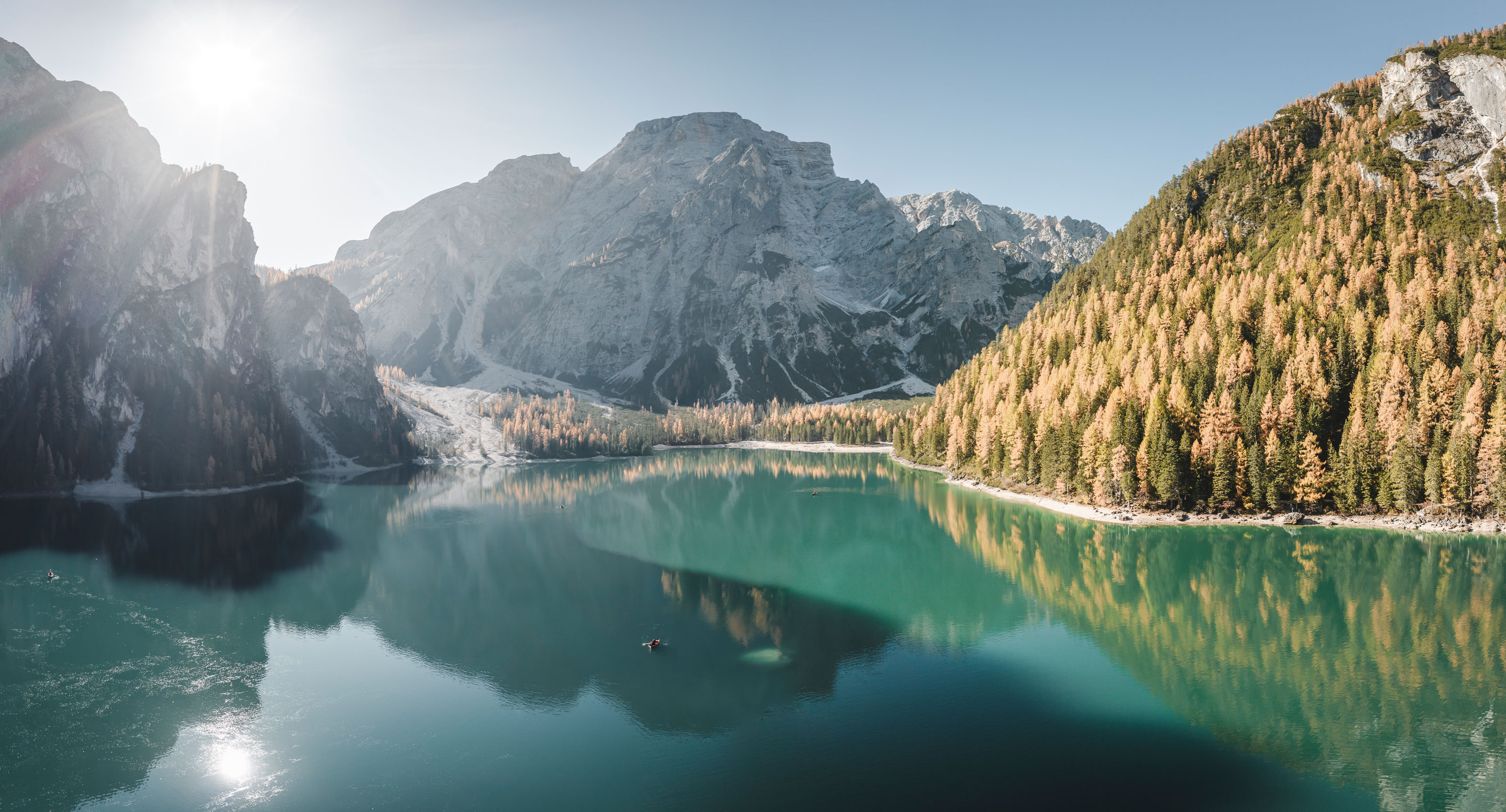
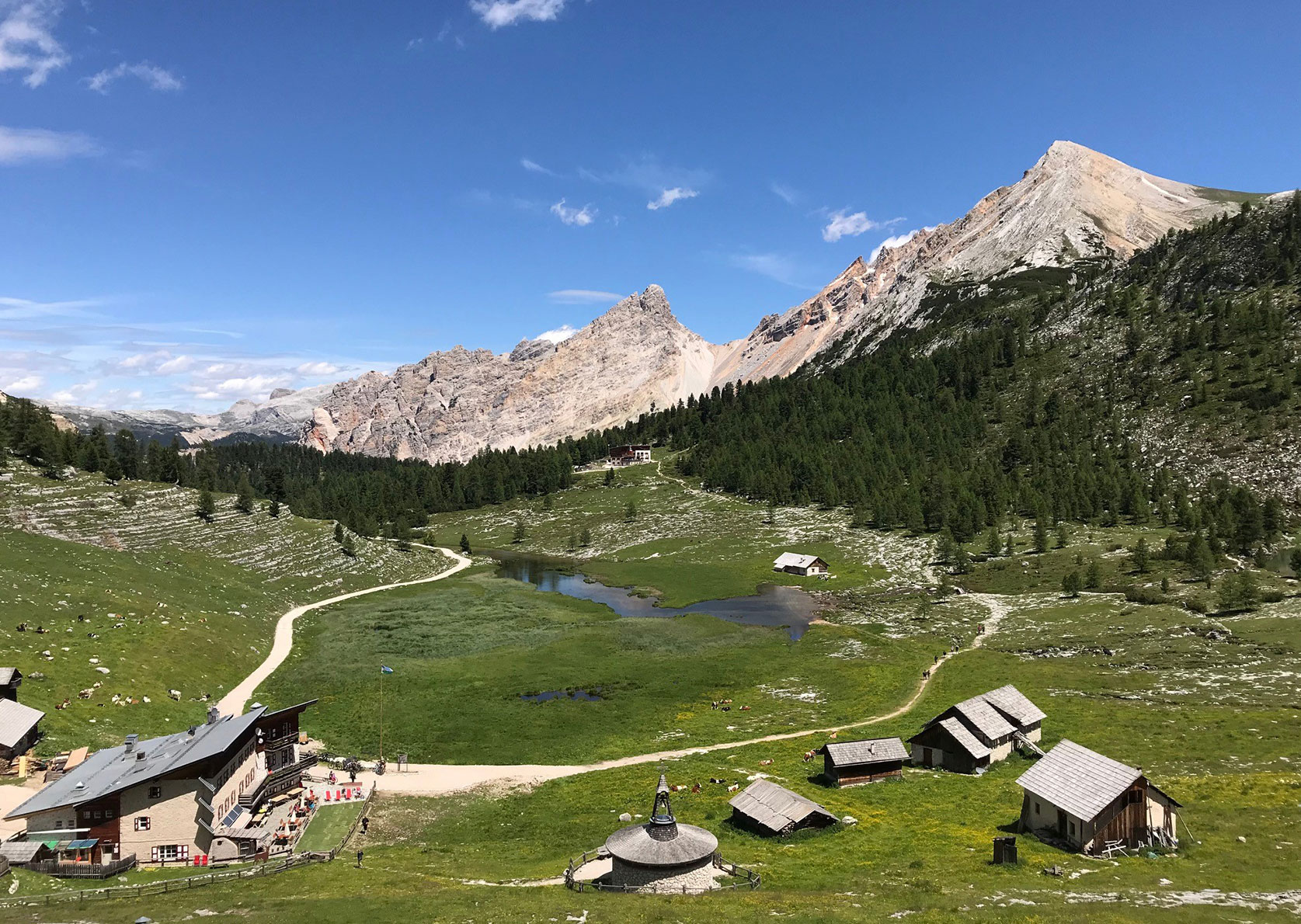
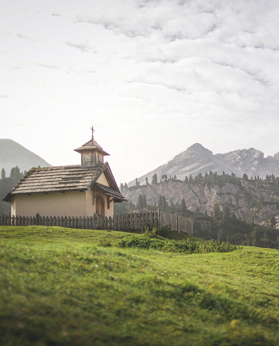
It starts at Lago di Braies lake, part of the Dolomites UNESCO World Heritage Site, and film location of the popular German series ‘Die Bergpolizei’, featuring Terence Hill. Legendary mountains such as the Fanes Group, Cinque Torri and Tofana all feature along this long-distance trail, with countless options to branch off and take in a summit. Dream views across to the Marmolada Glacier are just as much a part of it, as are memorials and museums in honour of those who died on the mountain front during the First World War, which left its scar on more than just the mountains. Some sections require hikers to be very surefooted and have a good head for heights.
In addition to the Dolomites Alta Via 1, there are now nine further mountain ridgeway routes in the Dolomites, some requiring mountaineering skills. Find out more here.
Tour Profile Dolomites Alta Via 1
Data & Terrain
Skills & Info
Grading
Recommended Footwear
Country: Italy
Length: 115 – 150 km
Vertical metres: 10,000 – 13,000
Stages: 13
Duration: 1 ½ – 2 weeks
Terrain: alpine and high-alpine terrain
Suitable for: Mountain hikers with a good basic level of fitness and mountaineering experience
Accommodation: Mountain huts, guesthouses, hotels. Wild camping is not permitted, only emergency bivouacking.
Personal requirements: Alpine hiking experience, surefootedness, good fitness levels: some rock climbing experience an advantage
Navigation ability: signposted; Map and compass reading skills; GPS device (optional)
Info: dolomitemountains.com
Reading: Trekking in the Dolomites Alta Via 1 and Alta Via 2 with Alta Via 3 – 6 in outline, Cicerone Press; Walking in the Dolomites
25 multi-day routes in Italy’s Dolomites, Cicerone Press.

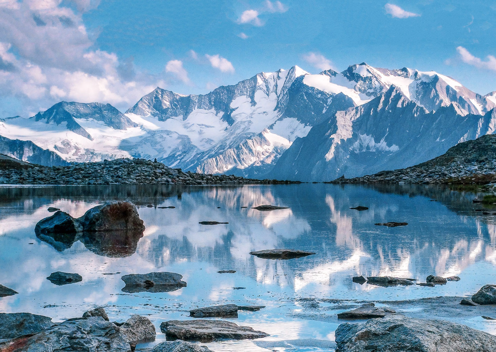
3 Tour du Mont Blanc
The Mont Blanc Massif – roof of the Alps and home of alpinism. The 170-kilometre-long, high-level, multi-day trek runs around the highest mountain in the Alps, with plenty of vertical metres thrown in. The 4,810-metre-high mountain attracts mountaineering fans from all over the World. But there are few better ways to admire the snowy white mass of rock and ice than on this panoramic circumnavigation around its base.
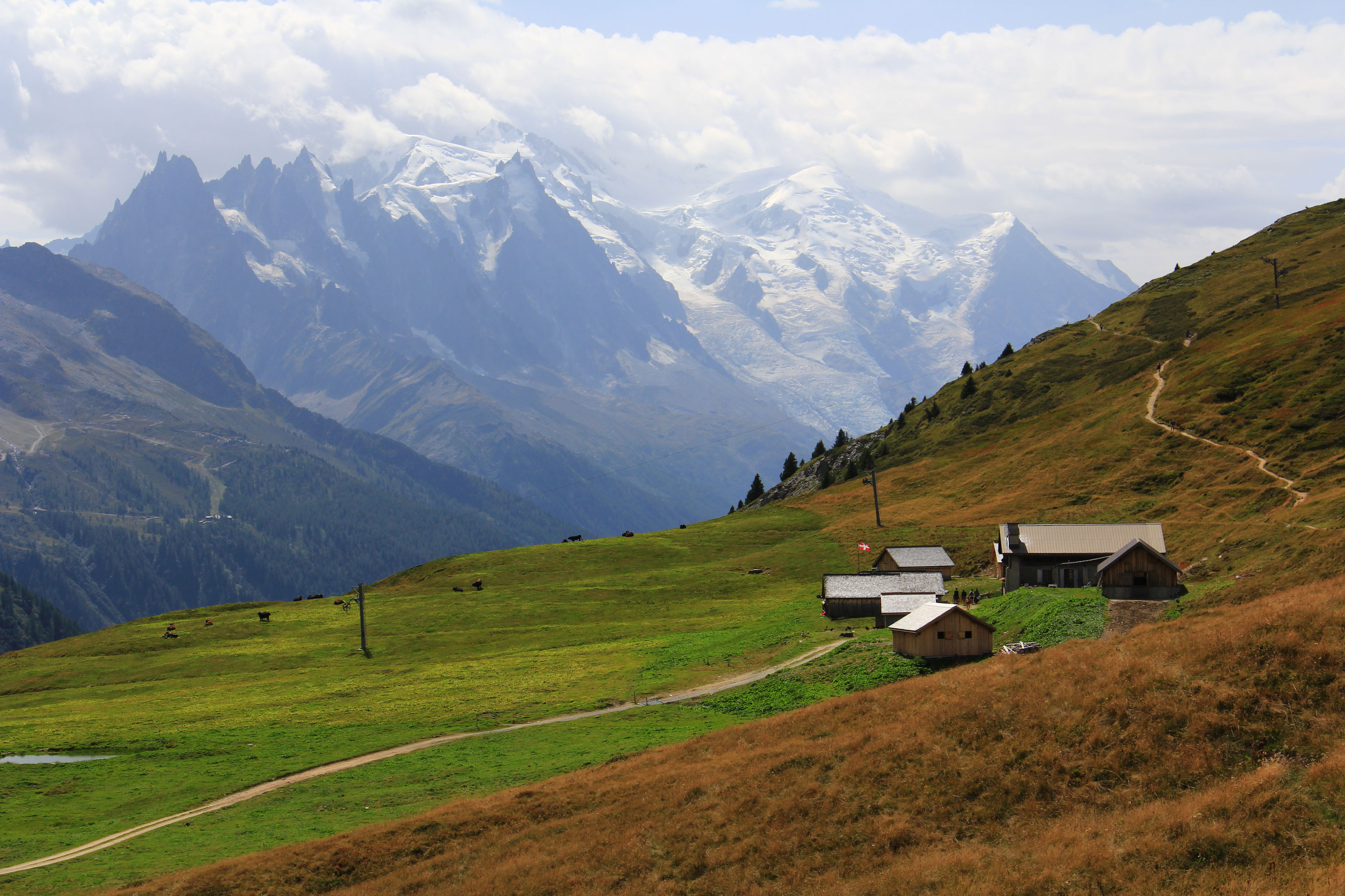
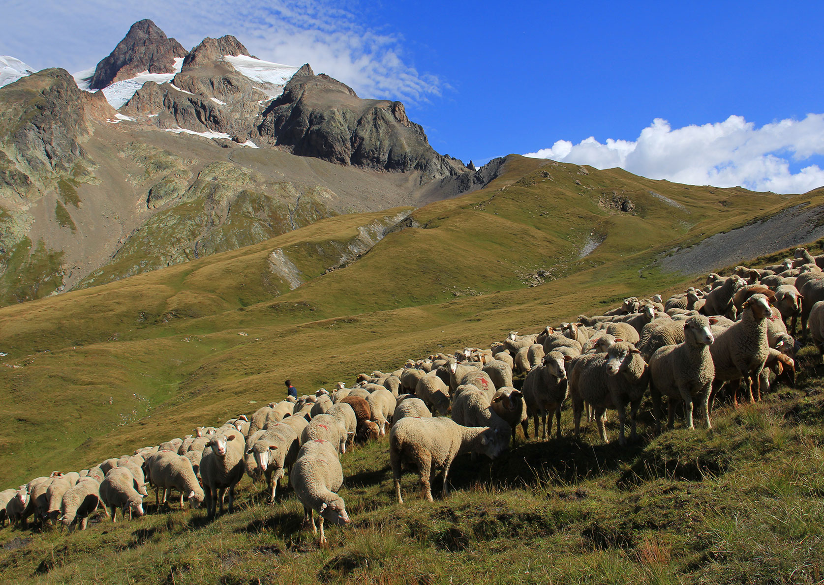
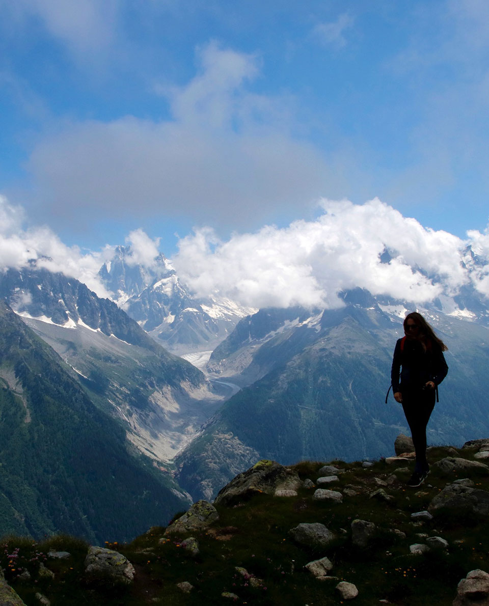
However wild and dangerous the seracs, granite walls and rocky outcrops of the Grandes Jorasses or the Gervasutti Pillar may be, the Tour du Mont Blanc is quite the opposite: on well-marked and well-maintained mountain paths through the three-country triangle of France, Italy and Switzerland.
You can choose to spend the night in mountain huts, guesthouses or hotels in the valleys – or even in a converted cowshed on an alpine pasture. The long-distance hike into the heart of the Western Alps ‘only’ takes a week and a half – but the spectacle and experience of it all will last a lifetime.
Tour Profile Tour du Mont Blanc
Data & Terrain
Skills & Info
Grading
Recommended Footwear
Countries: France, Switzerland, Italy
Length: 170 km
Vertical metres: 10,000 – 12,000
Stages: 10
Duration: 10 days
Terrain: alpine and high-alpine terrain
Suitable for: Mountain hikers with a good level of fitness and mountaineering experience
Accommodation: Mountain huts, guesthouses, hotels. Wild camping is not permitted, only emergency bivouacking.
Personal requirements: Alpine hiking experience, surefootedness, good fitness levels
Navigation ability: signposted; Map and compass reading skills; GPS device (optional)
Info: autourdumontblanc.com
Reading: Trekking the Tour of Mont Blanc, Cicerone Press; Tour du Mont Blanc: The most iconic long-distance, circular trail in the Alps, Vertebrate Publishing
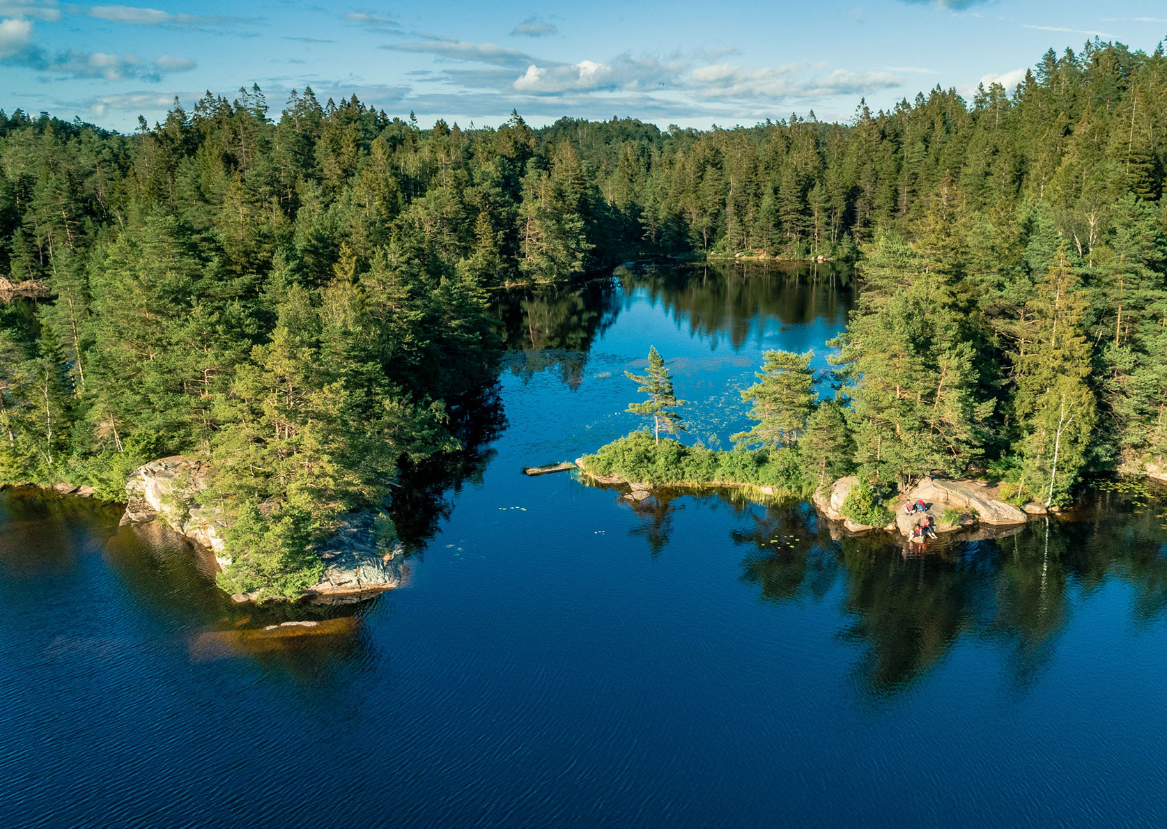
4 Bohusleden
Endless forests and lakes as far as the eye can see, summer days when the sun doesn’t want to set and the rock in the Skagerrak archipelago warms up nicely. The Bohusleden long-distance walk is way more Swedish than even the longest trek through the aisles of your local Ikea branch. And yet, this hiking trail is so well conceived that it could well have been created by Scandinavian designers.
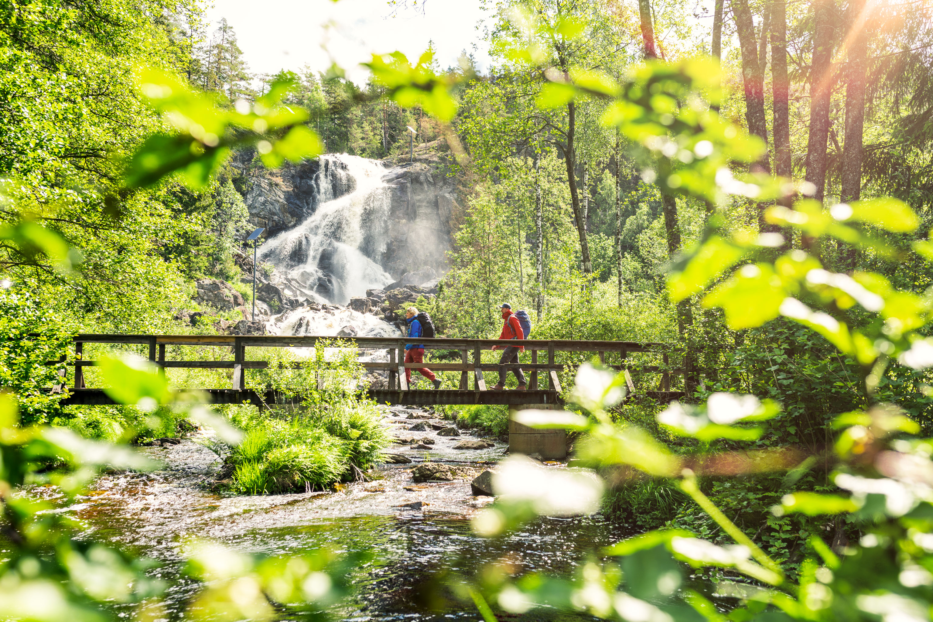
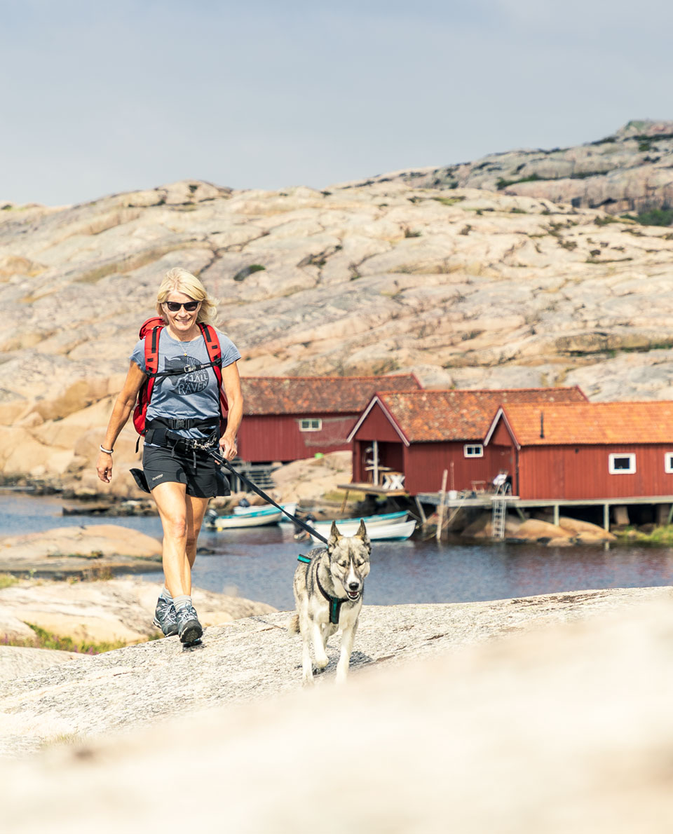
Overnight accommodation in simple huts for weather protection as well as marked drinking water sites are laid on for comfort-conscious long-distance hikers. The entire trail is well signposted with orange-coloured way markers. Losing your way is virtually impossible. But bringing along a map is still advisable. As is a tent, sleeping bag and stove. That’s because Sweden’s right to roam rule means that considered, respectful, low-impact overnight stays are permitted almost anywhere. So why not discover this Nordic adventure for yourself?
Tour Profile Bohusleden
Data & Terrain
Skills & Info
Grading
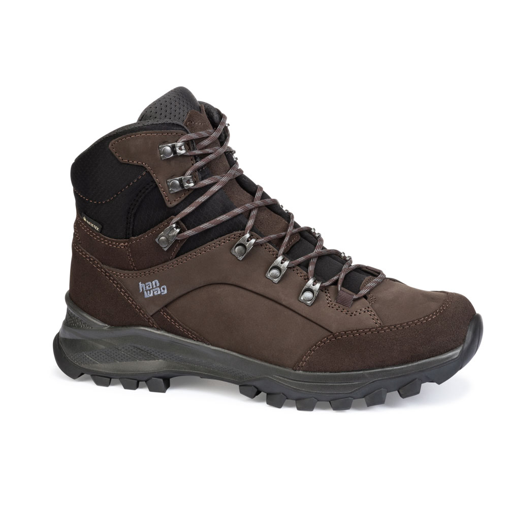
Recommended Footwear
Country: Sweden
Length: 340 km
Vertical metres: n/a
Stages: 27
Duration: approx. 3-4 weeks
Terrain: relatively flat, hilly Nordic woodland and lakes
Suitable for: Hikers with some experience of thru hiking; no mountaineering experience necessary
Accommodation: Wild camping (Everyman’s right: one night is permitted with respectful behaviour); simple, unserviced huts and overnighting sites
Personal requirements: Moderate level of fitness, suited to novice thru-hikers too
Navigation ability: signposted; Map and compass reading skills;
Info: bohusleden.se
Reading: Vandra Bohusleden (Hiking the Bohusleden), Calazo Förlag (in Swedish)

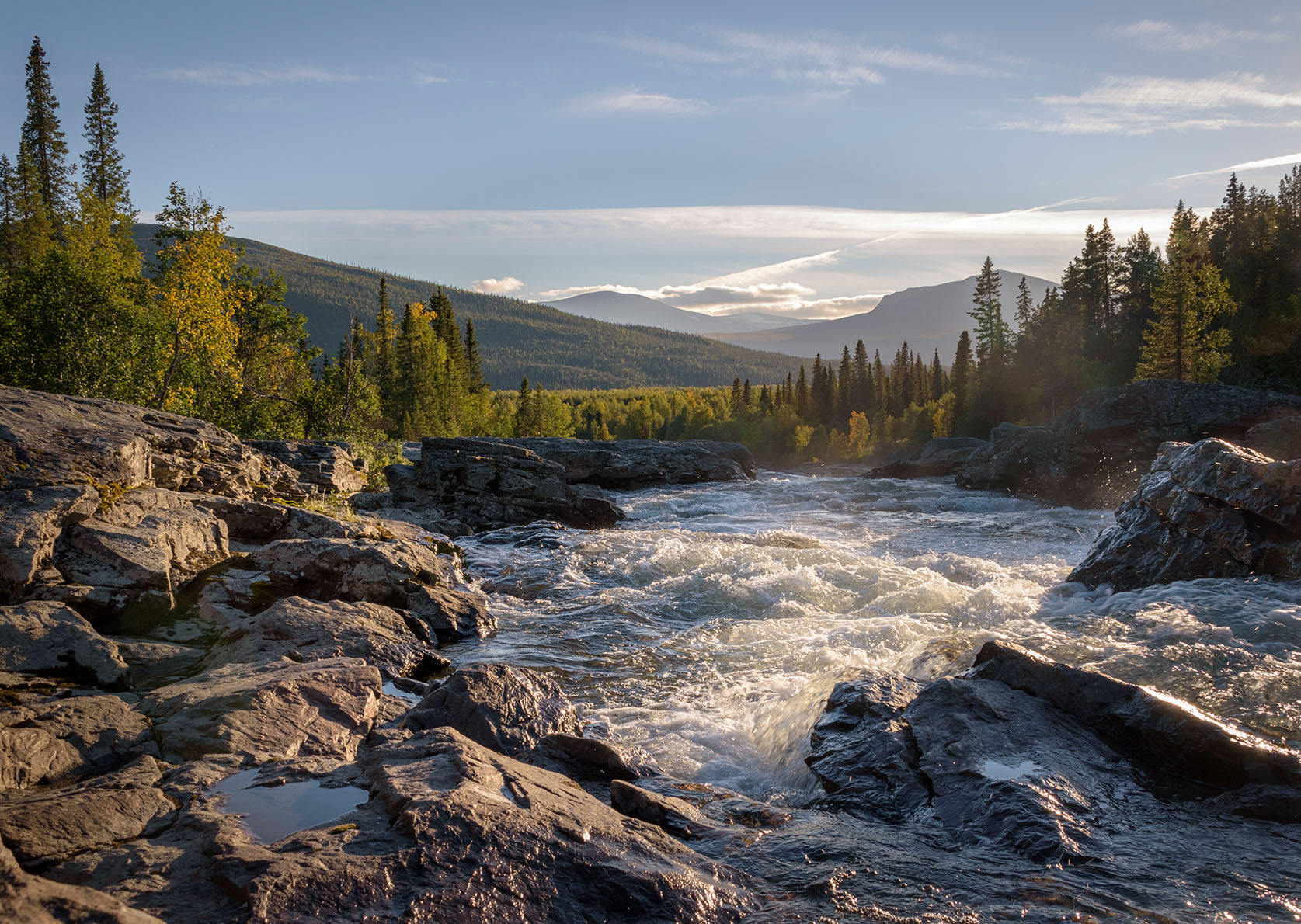
5 Kungsleden
The Kungsleden Trail is a highly scenic Swedish delight. The most popular section is the northern portion between Abisko to the north and Hemavan to the south. The Kungsleden – or literally king’s trail – is one of the most famous long-distance hiking trails in Europe and lives up to its regal heritage. It’s even suited to novice long-distance hikers, as long as they’re relatively weatherproof. Even though this is the land of the midnight sun, sunshine is not a given through mid-summer. Strongs winds and horizontal rain are not at all uncommon. But at least there are no steep climbs on this trail.
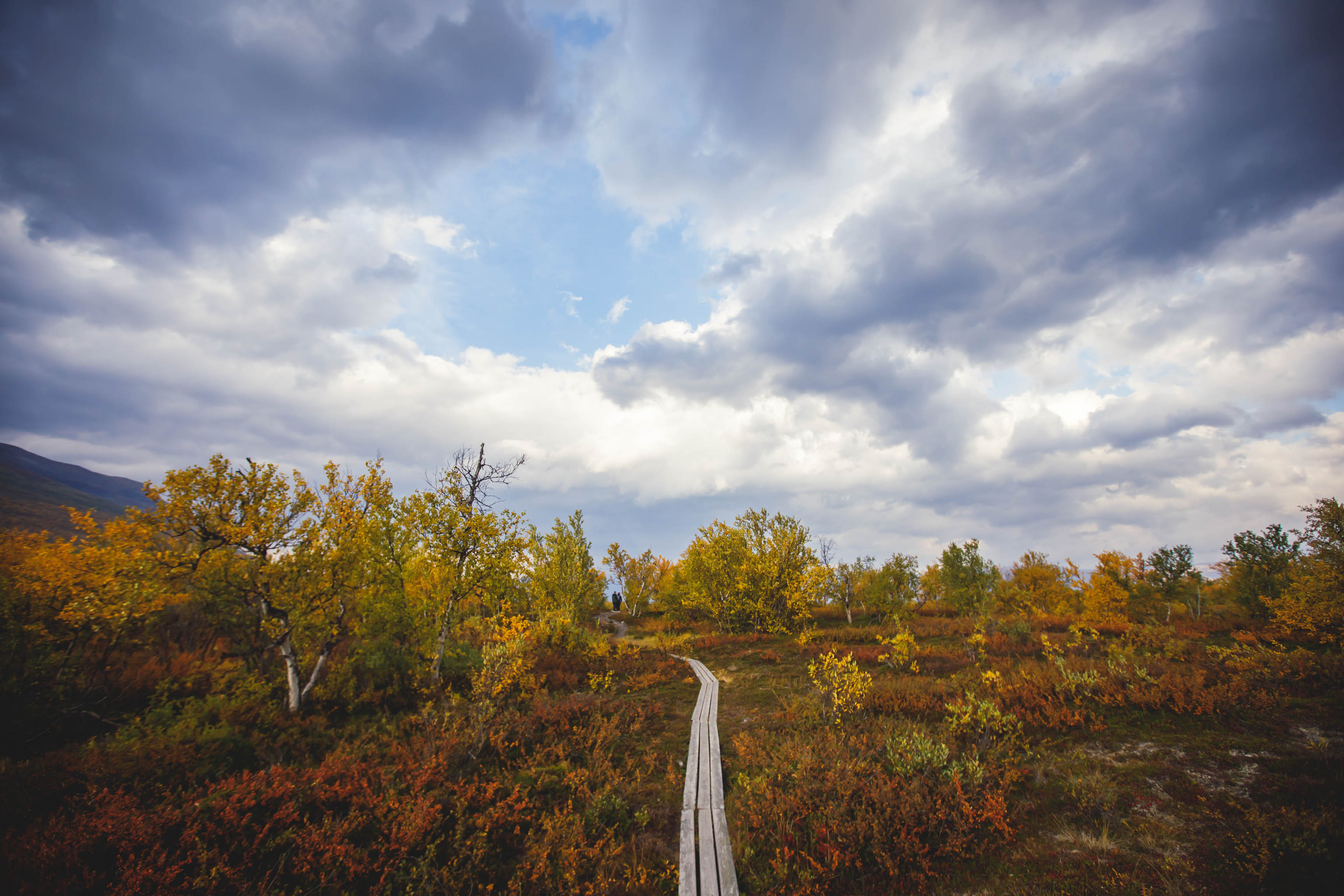
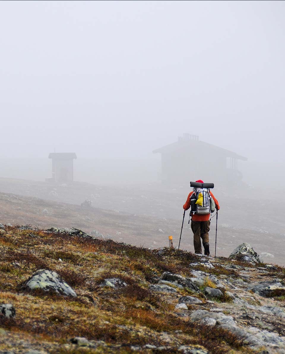
If you intend to stay overnight in the huts along the trail, then you must book in advance. But for the genuine thru-hiking experience, a night under canvas is the way forward. And according to Sweden’s freedom to roam or everyman’s right, you can pitch your tent anywhere as long as it’s done with respect and consideration. If you make the most of the long days in the far North, the 440-kilometre-long north section is like a bargain of a long-distance hike for seasoned thru-hikers. So why not bolt on the somewhat less-frequented, more forested, 350-kilometre-long southern section as well?
Tour Profile Kungsleden
Data & Terrain
Skills & Info
Grading
Recommended Footwear
Country: Sweden
Length: 790 (South section 350 km, North section 440 km)
Vertical metres: North: 8,500; South: 6,500
Stages: North: 20 – 25, South: 17
Duration: North: approx. 3 – 4 weeks; South: approx. 2 ½ – 3 weeks
Terrain: Nordic fells landscape with wide plains and high peaks
Suitable for: Hikers with some experience of thru hiking and wild camping; no mountaineering experience necessary
Accommodation: Wild camping (Everyman’s right: one night is permitted with respectful behaviour); simple, unserviced huts and overnighting sites; marked water sources
Personal requirements: Hikers with some experience of thru hiking and wild camping; no mountaineering experience necessary
Navigation ability: Map reading skills; Trail is signposted however
Info: visitsweden.com
Reading: Trekking the Kungsleden, Cicerone Press; Plan & Go | Kungsleden: All you need to know to complete Sweden’s Royal Trail (Plan & Go Hiking)
6 Pembrokeshire Coast Path
It doesn’t have to be the highest mountains, the Alps, the Andes or the Himalayas. Long-distance hiking can also be done by the seaside. The 300-kilometre Pembrokeshire Coast Path on the west coast of Wales is one of the most stunning coastal trails in the world. Wild sea cliffs, endless beaches, dunes, rare seabirds, seals, dolphins – it has it all.
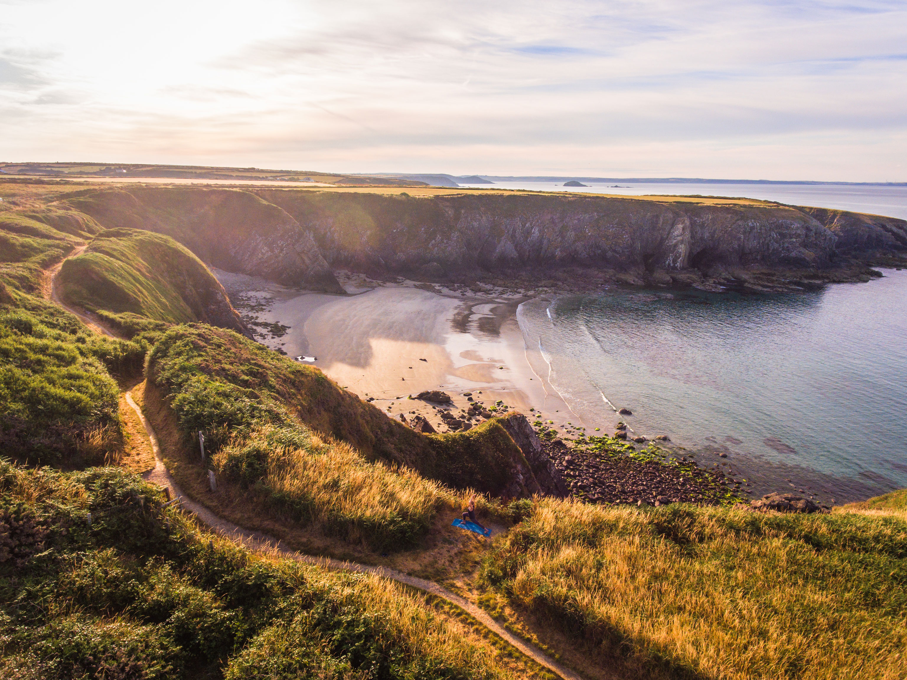
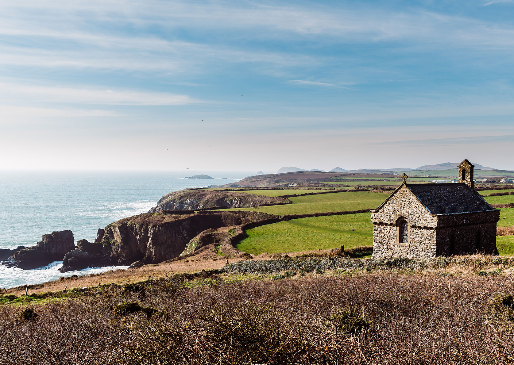
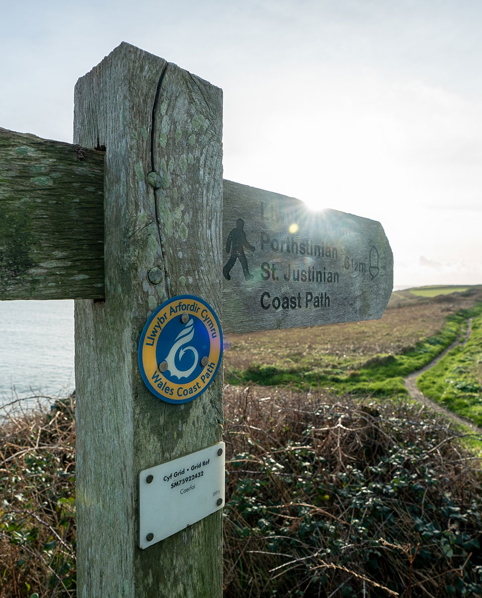
The route runs between Amroth in the south and St Dogmaels on Cardigan Bay in the north and is absolutely breathtaking. And if you thought that hiking along the coast would mean it’s flat, then think again. You’ll clock up a full 8,500 vertical metres on this long-distance trail. And breathing in all that healthy sea air as you go.
The southern part is more sandy, and in the north there are high, rugged cliffs. Stone buildings huddle against the rocks and picturesque villages exude the charm of times gone-by when little boats would set out every day in the bays here to catch fish in the choppy seas. It’s definitely one of the most beautiful long-distance hiking trails in Europe.
Tour Profile Pembrokeshire Coast Path
Data & Terrain
Skills & Info
Grading
Recommended Footwear
Country: Wales
Length: 300 km
Vertical metres: approx. 8,500
Stages: 10-15
Duration: 10-15 days
Terrain: Varied coastal landscape with sandy bays and steep sea cliffs
Suitable for: Long-distance hikers, walking enthusiasts, surf nomads and anyone with a soft spot for the sea.
Accommodation: Campsites (very few), wild camping not permitted. Hostels, B&Bs or stylish manor houses
Personal requirements: Good stamina
Navigation ability: Basic map reading skills
Info: visitpembrokeshire.com; visitwales.com
Reading: Pembrokeshire Coast Path (National Trail Guides); Walking the Pembrokeshire Coast Path, Cicerone Press; Pembrokeshire Coast Path by Jim Manthorpe

7 Te Araroa Trail
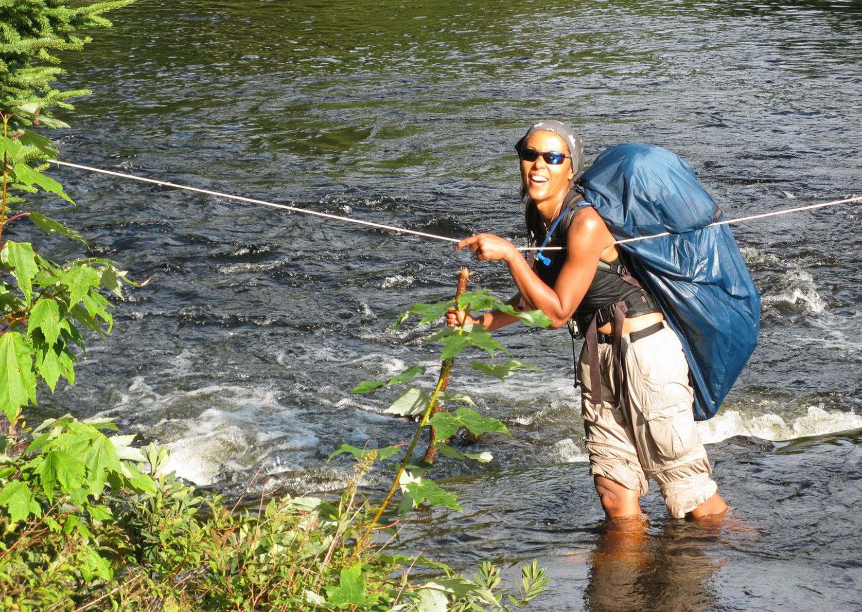
Some long-distance hiking routes immerse hikers deep in nature and then spit them out, at what few restocking stations there are along the way, or where food can be stashed. Not so the Te Araroa Trail in New Zealand. On this long-distance walk at the other end of the world, you’ll get to know the locals, see the wildlife, and experience lush tropical forests, alpine-scale mountains, smouldering volcanoes, geysers and white sandy beaches. The idea is to really get to know the country and its people.
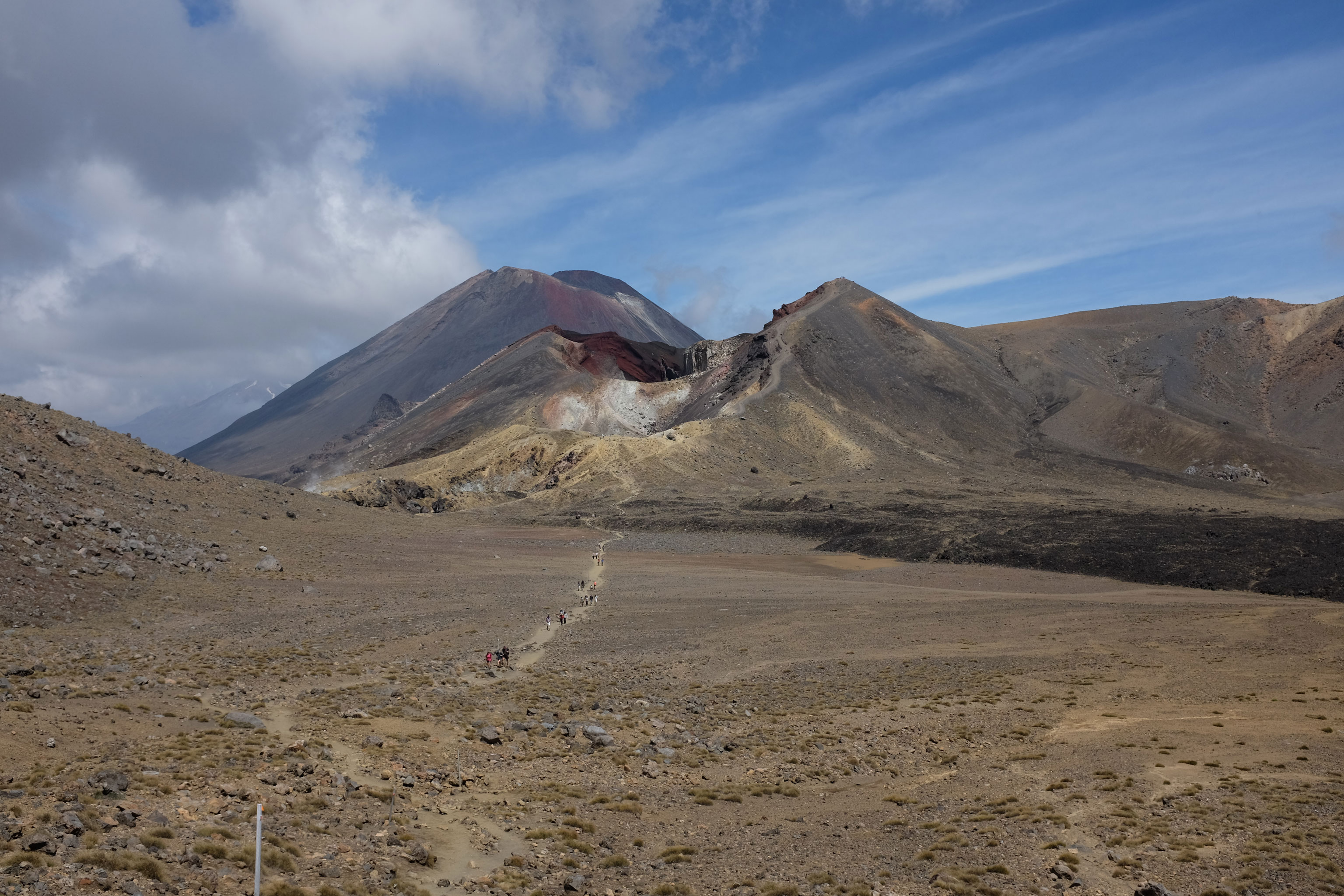
This 3,000-kilometre-long trail from Cape Reinga in the north to the southern tip of New Zealand is signposted and marked, but requires sound outdoor experience in parts and some improvisational skills. It includes well-known New Zealand hiking trails, and leads through areas that barely feature in standard hiking guides.
Tour Profile Te Araroa Trail
Data & Terrain
Skills & Info
Grading
Recommended Footwear
Country: New Zealand
Length: 3,000 km
Vertical metres: approx. 97,000
Stages: Whatever you choose
Duration: 4-6 months
Terrain: Highly varied: Beaches, high-alpine mountains, rainforest.
Suitable for: Adventurous hikers, with a love of paradise-like landscapes and a desire to get to know the country and its people.
Accommodation: Huts, campsites, hostels, hotels
Personal requirements: Some sections require extensive trekking experience and some mountaineering skills. Good level of fitness.
Navigation ability: Comfortable using a map/compass/ GPS.
Info: teararoa.org.nz
Reading: Te Araroa – A Walking Guide to New Zealand’s Long Trail, Penguin Random House; Te Araroa : walking New Zealand’s 3000-kilometre trail
by Mark Watson; A Walking Guide To New Zealand’s Long Trail: Te Araroa by Geoff Chapple

8 Annapurna Circuit
The Annapurna Circuit is considered one of the most impressive trekking trails in the world with the majestic snow-capped Himalayan peaks forming the backdrop throughout. The world-famous, and (depending on what time of year) highly popular trail that circumnavigates the 8,091-metre-high Annapurna Massif meanders through wide Himalayan valleys with breathtaking views.
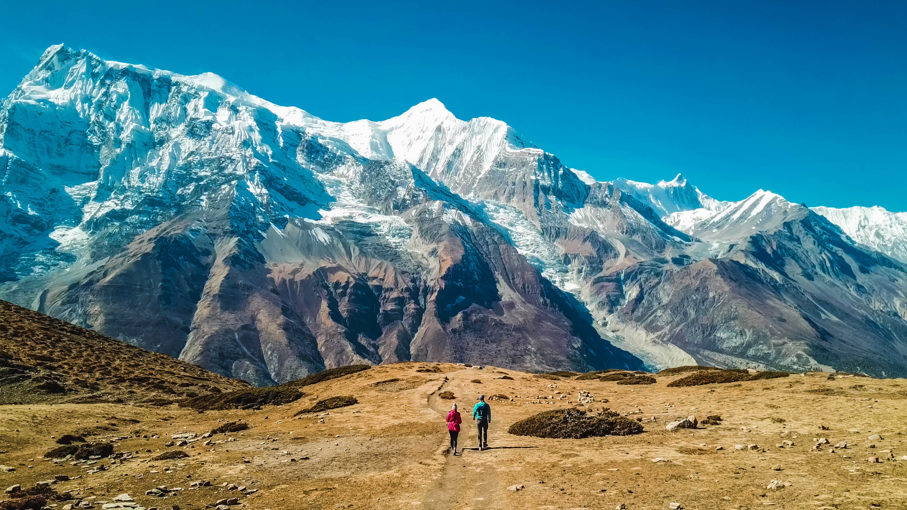
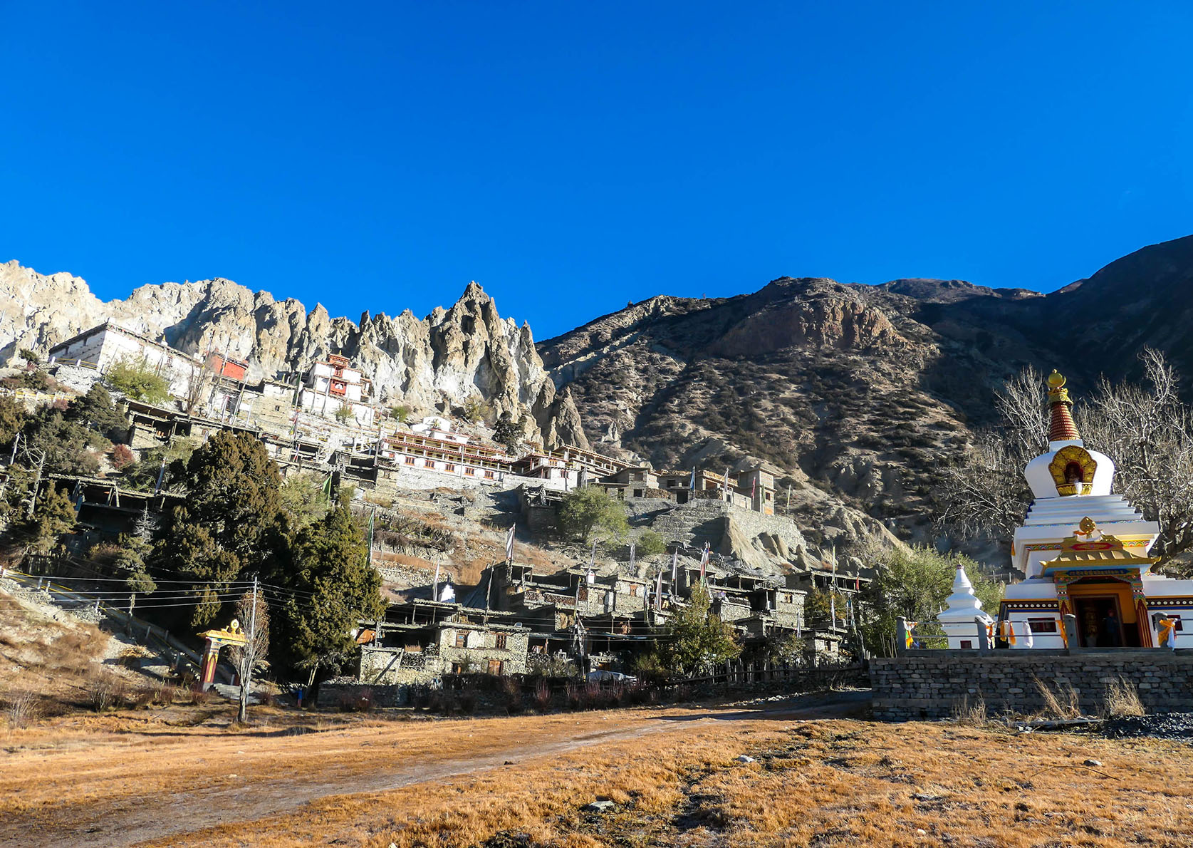
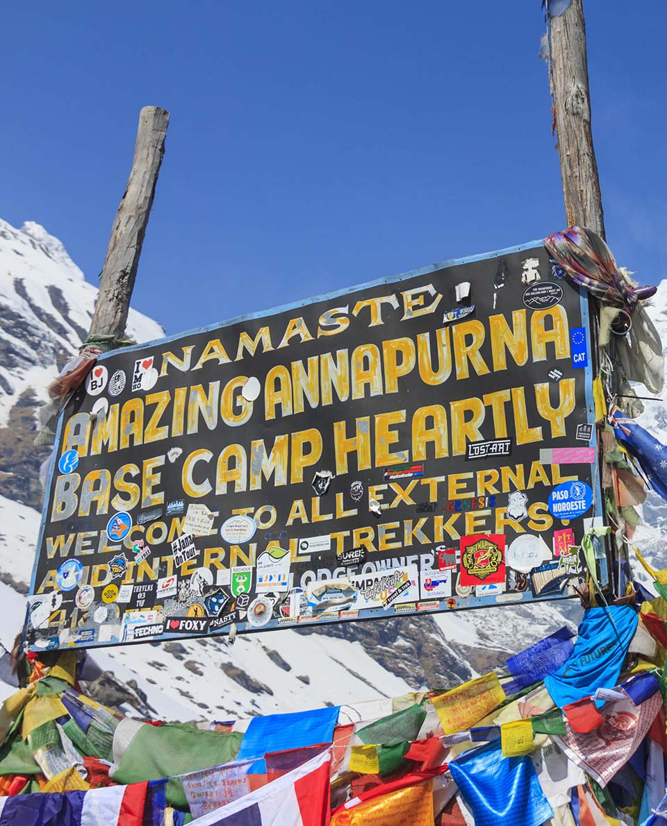
From the start, this long-distance hiking trail of manageable length passes through nearly every type of climate. The highest point is Thorung La pass at 5,416 metres. Multiple overnight options and eateries along the way make logistics and luggage requirements easier to navigate. A permit is required to undertake the trail. You can do without a tent though. Making time for acclimatisation before you set off is advisable – to make the trail more enjoyable and prevent altitude sickness. Beginners can team up with one of the many commercial providers.
Tour Profile Annapurna Circuit
Data & Terrain
Skills & Info
Grading
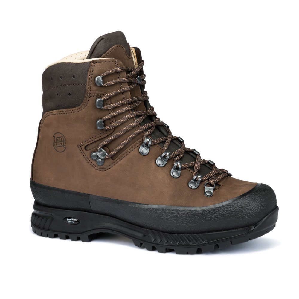
Recommended Footwear
Country: Nepal
Length: 230 km
Vertical metres: 14,500
Stages: Whatever you choose
Duration: 2-3 weeks
Terrain: Himalayan valleys with varying vegetation and climatic zones, high-mountain terrain
Suitable for: High-altitude hikers short on time, not for solitude-seeking hermits
Accommodation: Teahouses lodges hostels
Personal requirements: Good level of fitness. Acclimatisation.
Navigation ability: Good navigation skills.
Info: welcomenepal.com
Reading: Trekking the Annapurna Circuit, Himalayan Map House; Annapurna, 14 treks including the Annapurna Circuit and Sanctuary, Cicerone Press
9 Snowman Trek
Bhutan – Shangri-La – a kingdom hidden away in the Himalayas with a state mandate to achieve happiness as a national goal (Gross National Happiness – or GNH). But sometimes, that happiness is hard earned. On the Snowman Trek, hikers have to make their way across 13 mountain passes up to 5,400 metres high. The Snowman Trek is considered one of the toughest treks or long-distance trails in the world – and it is definitely one of the most captivating. Good stamina and acclimatisation are a matter of course. In return, you will be rewarded with unforgettable scenic beauty, interactions with inspirational people and wonderful solitude.
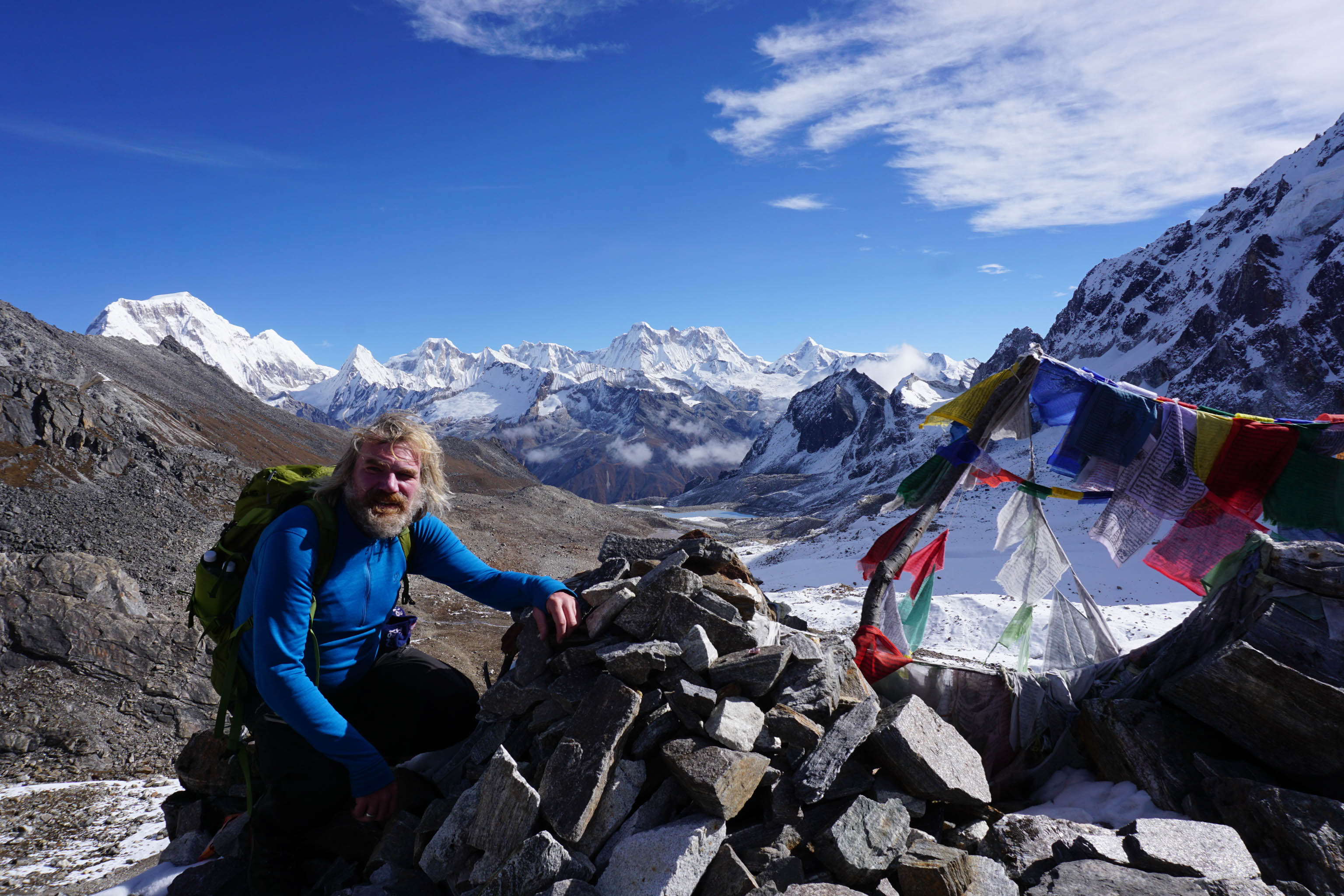
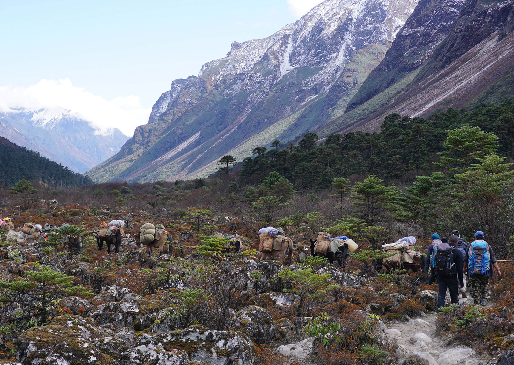
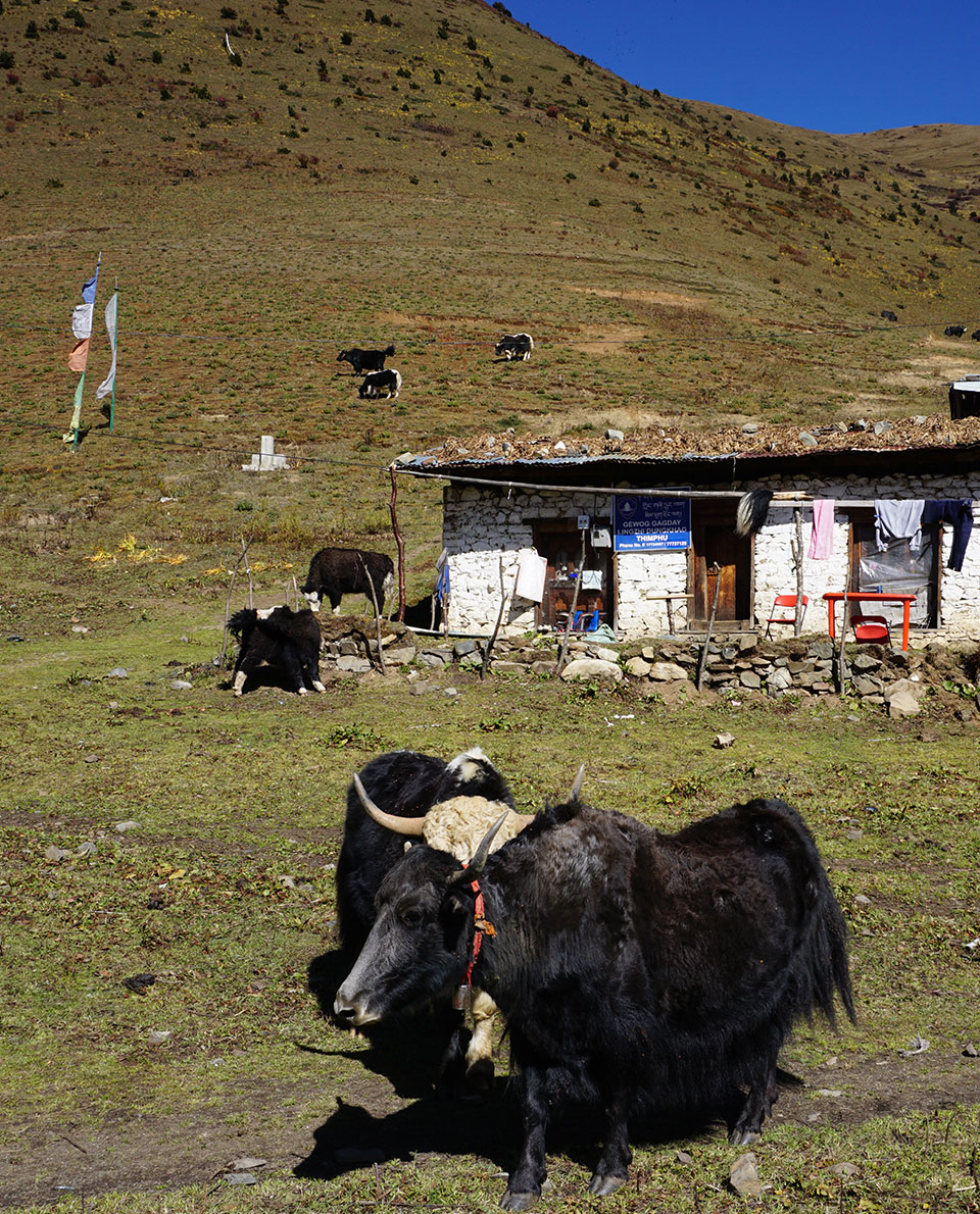
The trail is based on yak-herder routes and connects Bhutan’s high-alpine valleys. There are monasteries and heritage sites along the way, with glaciated six- and seven-thousand-metre peaks as the backdrop. You won’t find a perfect infrastructure with countless lodges like in Nepal. But you will find memories to last you a lifetime.
Tour Profile Snowman Trek
Data & Terrain
Skills & Info
Grading
Recommended Footwear
Country: Bhutan
Length: 240 km
Vertical metres: 12,000
Stages: 28
Duration: 4 weeks
Terrain: High Himalayan valleys and passes
Suitable for: Very fit, culturally interested adventure hikers and strong-minded individuals.
Accommodation: Tent for most stages
Personal requirements: Excellent stamina, good acclimatisation.
Navigation ability: Very good navigation skills, with map, compass, GPS
Info: trekking-in-bhutan.com
Reading: Der Snowman Trek in Bhutan: Trekkingabenteuer im Himalaya, Thorsten Hoyer, Conrad Stein Verlag (in German); Trekking in Bhutan
22 multi-day treks including the Lunana ‘Snowman’ Trek, Cicerone Press;

Further reading: Thru-hiking legend Thorsten Hoyer on the Snowman Trek in Bhutan
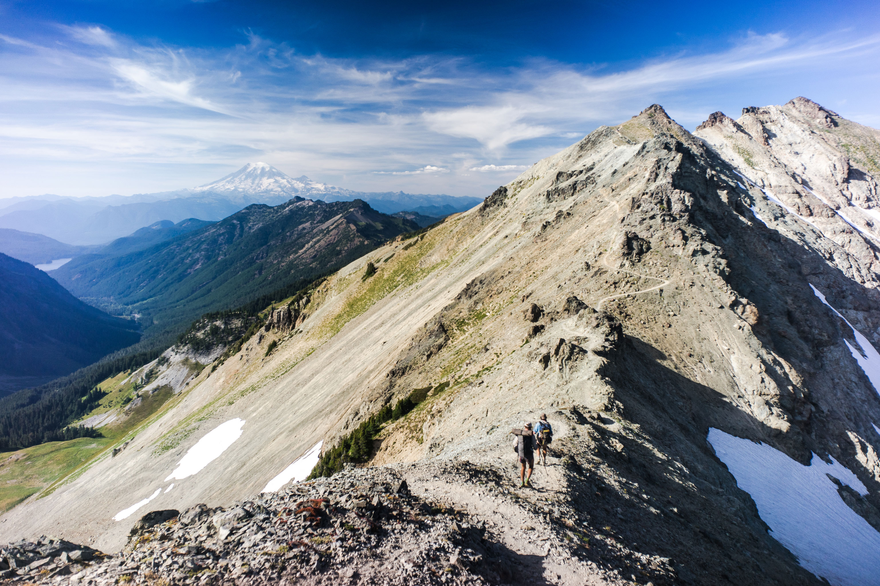
10 Pacific Crest Trail
The quintessential classic. It’s hard to find another long-distance trail that’s more legendary. For many thru hikers, it was and still is the first introduction to a life of tramping trails. Many of them not only found the wonders of nature and wilderness but also found their way back to themselves.
The varied 4,265-kilometre Pacific Crest Trail gained its fame largely through the book ‘Wild’ by Cheryl Strayed and film of the same name. In the movie, the main character is played by Reese Witherspoon. In the book, which has the subtitle ‘From Lost to Found on the Pacific Crest Trail’, Strayed describes how she, a wide-eyed thru-hiking novice, went through hell and back and found new inner poise on the trail following a turbulent phase of her life marred by heroin, unhealthy sexual exploits and divorce.
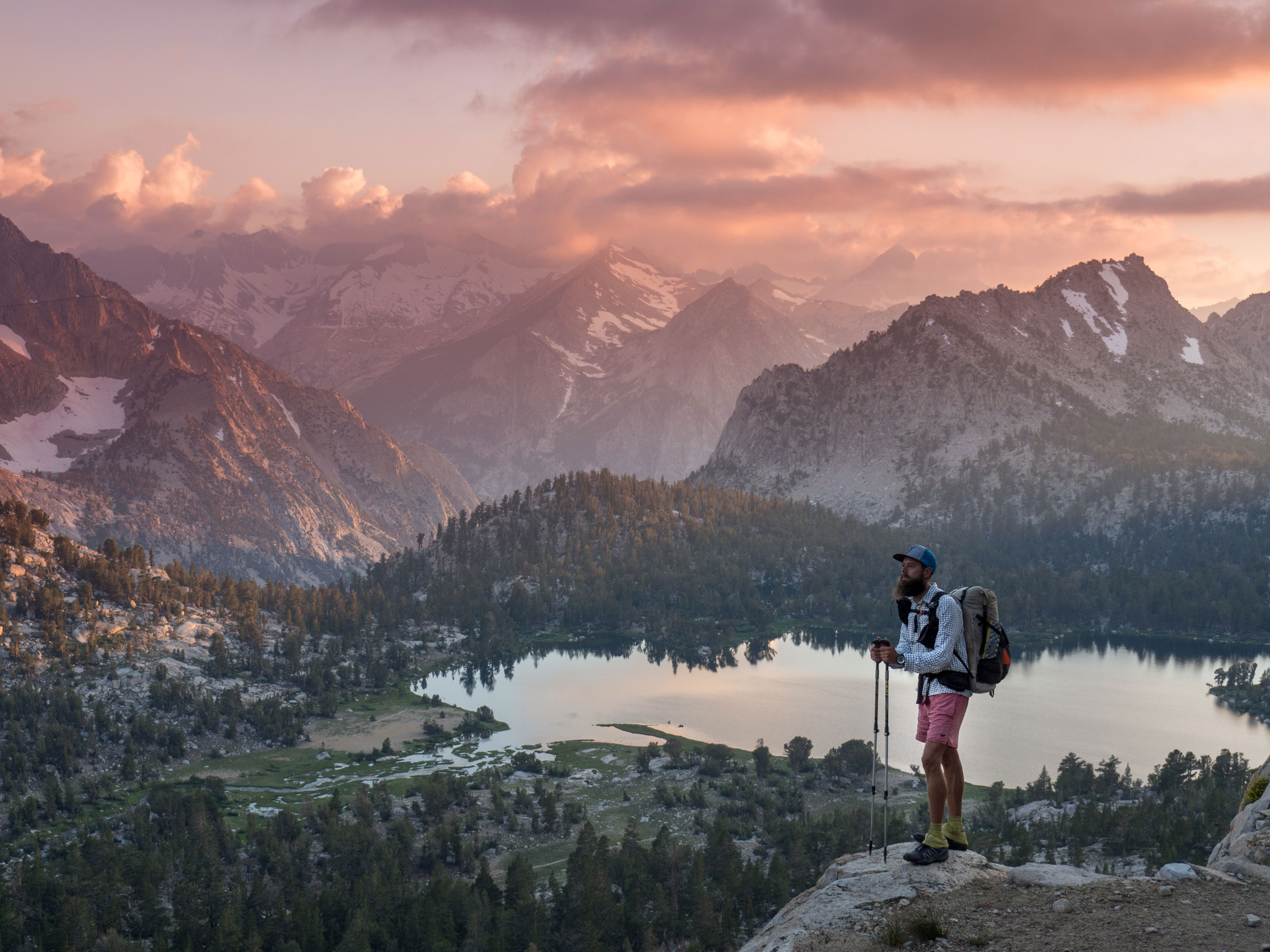
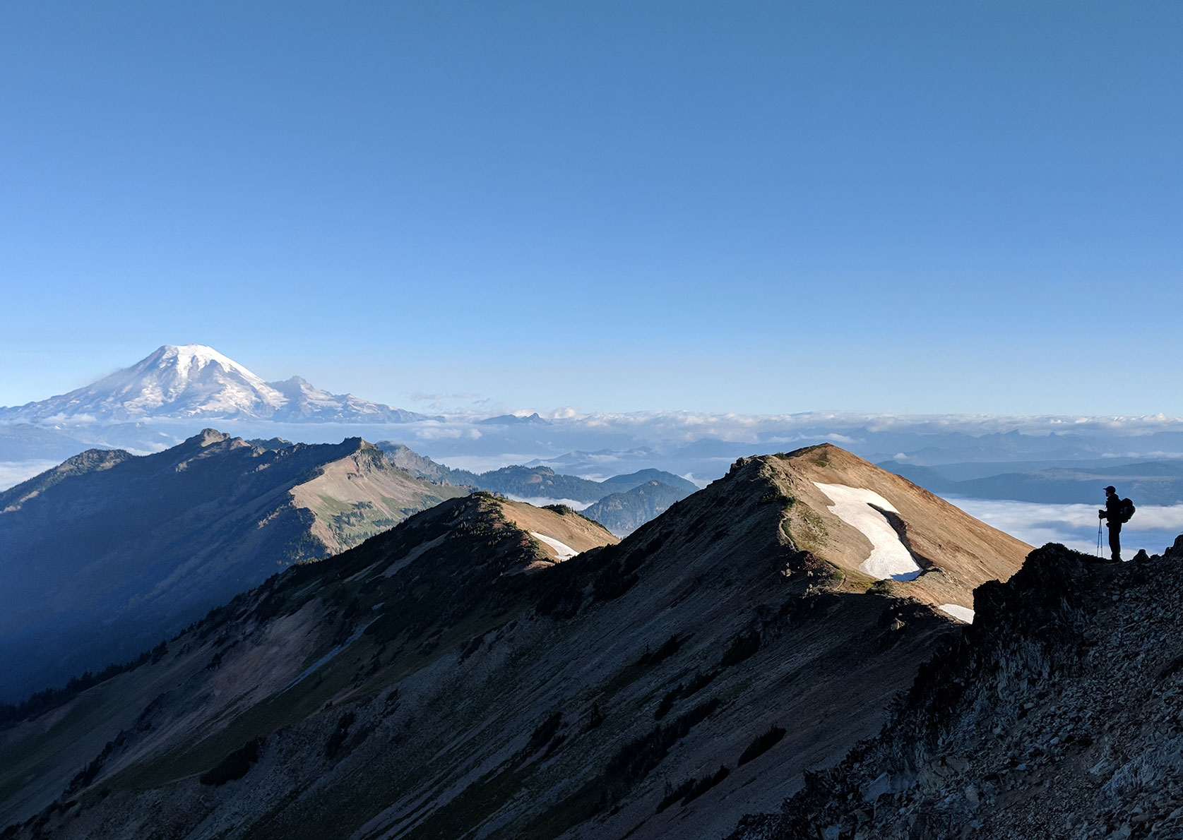
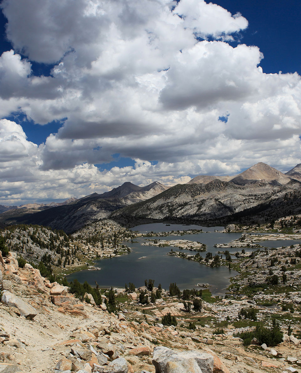
The well-marked route requires some outdoor skills but is also achievable for beginners. It runs through the states of California, Oregon and Washington – from the Mexican border on the Pacific through the mountain ranges of the Sierra Nevada and Cascade Mountains to the Canadian border.
It was a woman who came up with the idea for this long-distance hiking trail. Way back in 1926, Catherine Montgomery proposed a “high-altitude hiking trail across the peaks of the western mountains”. Since then, she’s known as the mother of the PCT.
Tour Profile Pacific Crest Trail
Data & Terrain
Skills & Info
Grading
Recommended Footwear
Country: USA
Length: 4,265 km
Vertical metres: 128,300
Stages: Whatever you choose
Duration: Approx. 6 months
Terrain: Largely mountainous, with some snow sections at some times of year
Suitable for: Individualists looking for peace and solitude, but who are also happy to find company on the trail occasionally.
Accommodation: Mostly tent. No huts.
Personal requirements: Very good stamina (develops automatically during the hike).
Navigation ability: Very good navigation skills, with map, compass, GPS
Info: pcta.org
Reading: Trekking The Pacific Crest Trail, Cicerone Press; How to hike the Pacific Crest Trail, Lonely Planet;

Further reading: Sanna Wandtke’s account of the Pacific Crest Trail
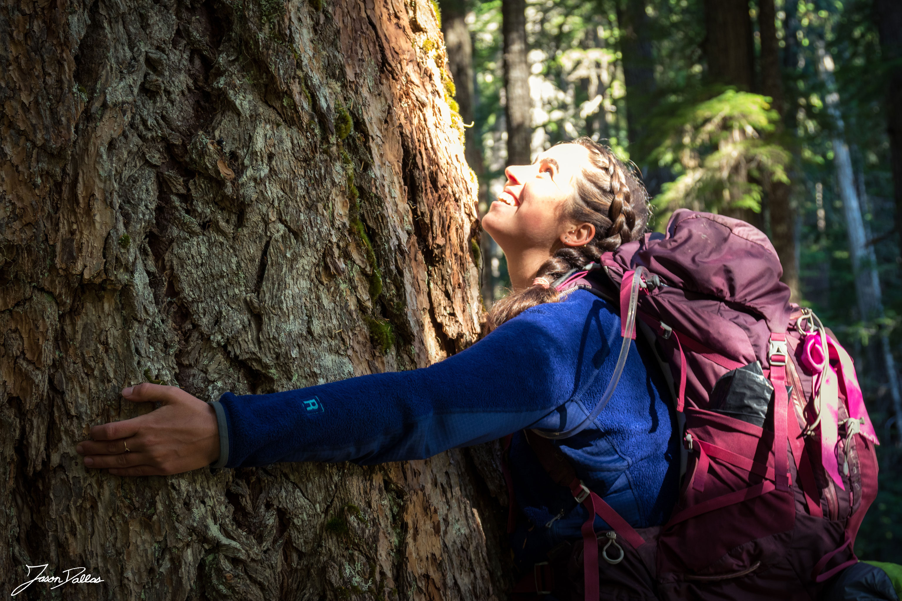
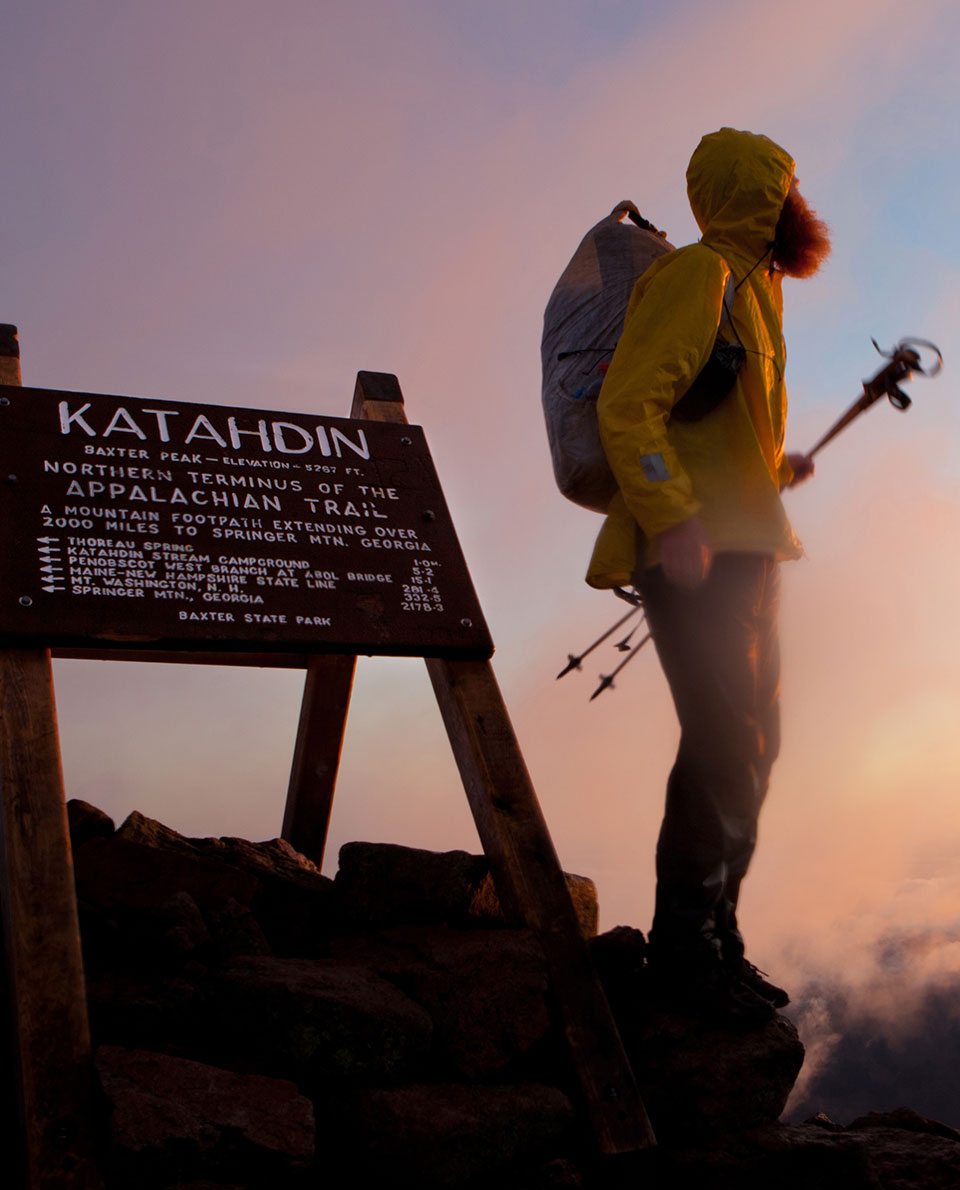
11 Appalachian Trail
The Appalachian Trail is to the east of the United States what the Pacific Crest Trail is to the west. It crosses 14 states over a distance of 3,500 kilometres and is considered something like the forefather of long-distance hiking trails. It’s almost exactly 100 years since forest scientist and environmentalist Benton MacKaye started to create a network of trails through the Appalachians. Even though some of the peaks are as high as 2,000 metres – including sections of easy scrambling sections – the Appalachians resemble Europe’s lower mountain ranges, though in places much less populated of course.
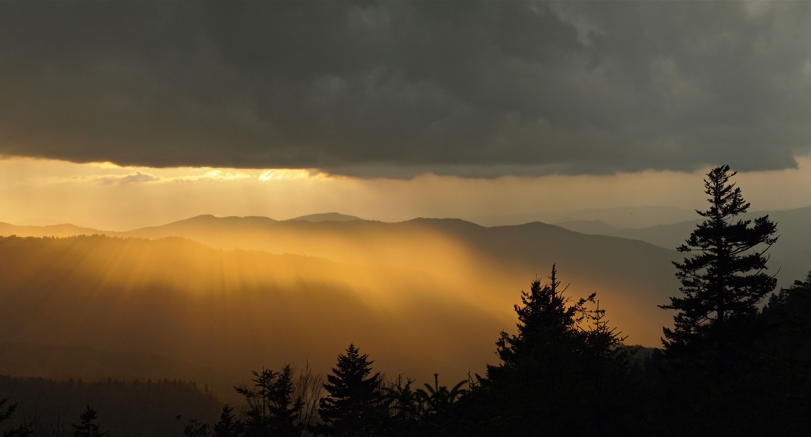
Still, you won’t be completely alone on the trail. It is a very popular thru-hike route and was made famous by the film ‘Picnic with Bears’ starring Robert Redford and Nick Nolte. Lovers of spectacular mountain panoramas tend not to get their money’s worth however, as a large part of the trail runs in the shade of the trees.
Tour Profile Appalachian Trail
Data & Terrain
Skills & Info
Grading
Recommended Footwear
Country: USA
Length: 3,500 km
Vertical metres: approx. 142,000
Stages: Whatever you choose
Duration: 4-6 months
Terrain: Lower ranges forest
Suitable for: Thru-hiking beginners and anyone interested in getting to know the thru-hike community
Accommodation: Tent or tarp and basic shelter huts
Personal requirements: Good level of fitness and basic outdoor skills.
Navigation ability: Basic map reading skills, trail is signposted
Info: appalachiantrail.org
Reading: The Green Tunnel – A Hiker’s Appalachian Trail Diary, virtualbookworm.com Publishing; The A.T. Guide – A Handbook for Hiking the Appalachian Trail

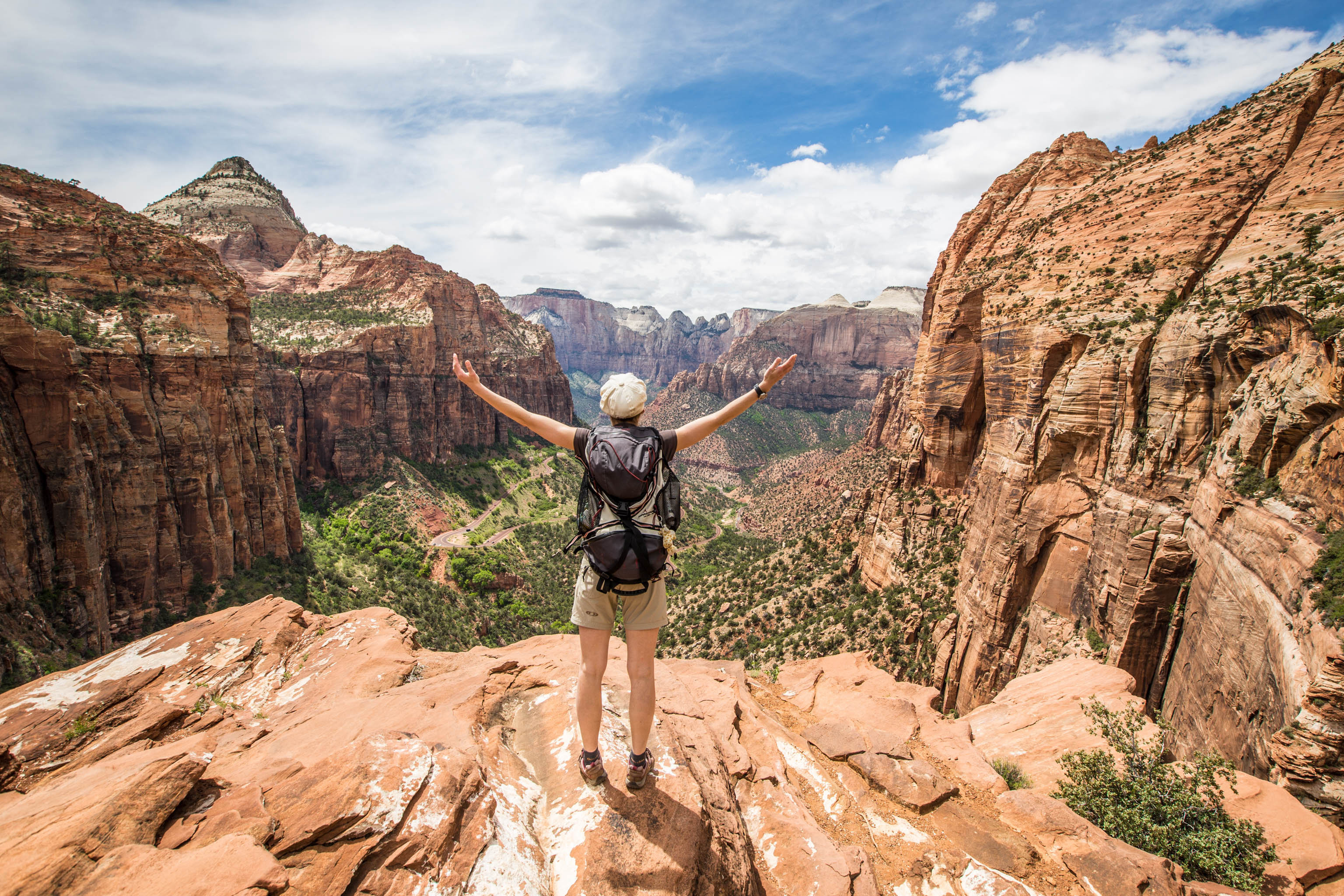
12 Huella Andina Trail
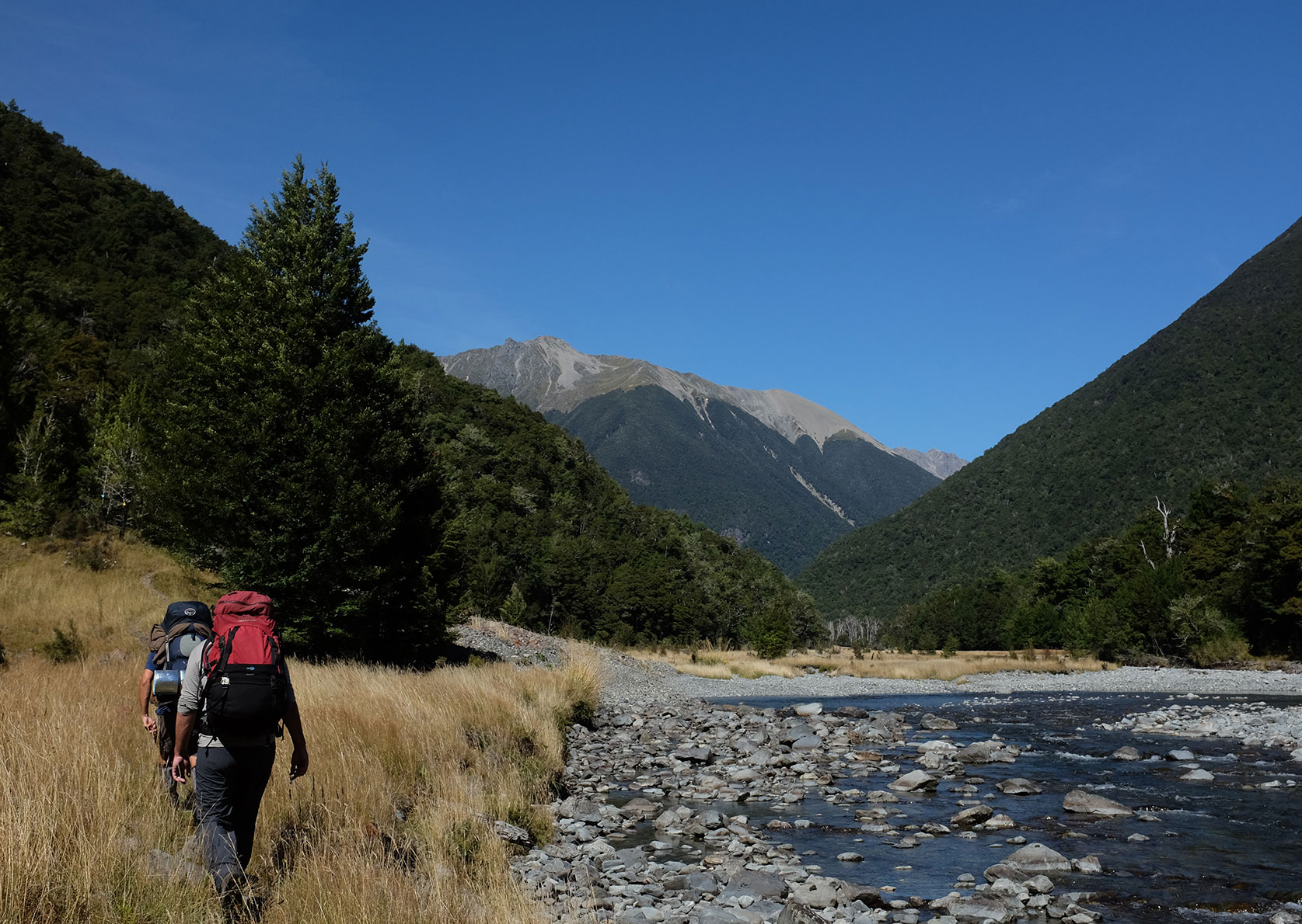
Patagonia – a dream destination for many trekking enthusiasts. The Huella Andina Trail runs through the north of the region – an area characterised by mountains like those in the Alps, volcanoes, sparkling lakes and, in parts, densely forested valleys. The government now no longer pays for the upkeep of the trail.
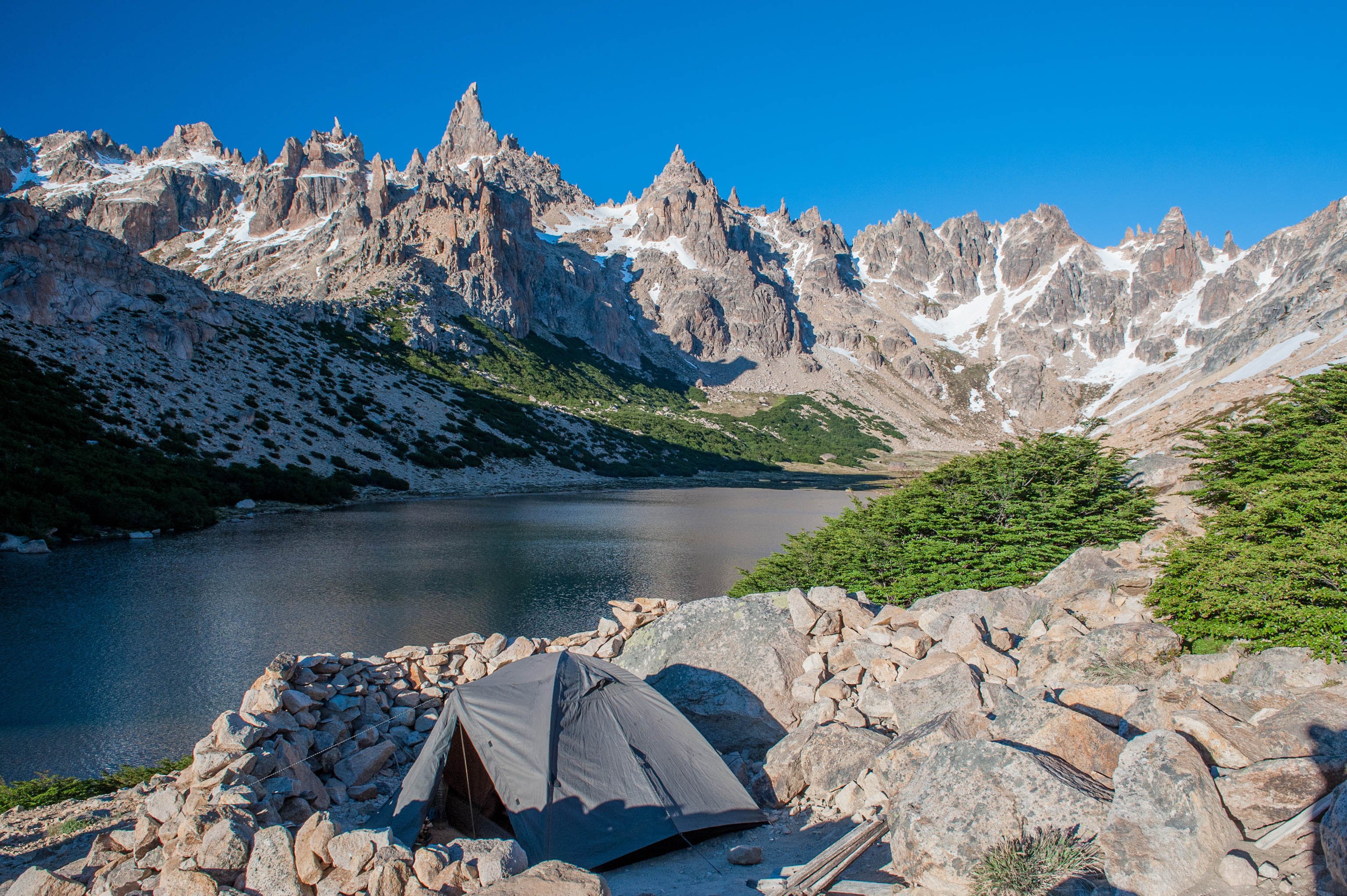
And so the route still exists but has become overgrown in parts and is not waymarked throughout any more. It leads from Pehuenia on Lago Moquehue in the north via Bariloche and El Bolson to Puerto Patriada a Lago Epuyén. Scenic highlights are dotted along this epic trail like a string of pearls. Heading south along this long-distance walk, you’ll hike through five national parks: Lanin, Nahuel Huapi, Los Arrayanes, Lago Puelo and Los Alerces. A dream come true for the more experienced adventurer.
Tour profile Huella Andina Trail
Data & Terrain
Skills & Info
Grading
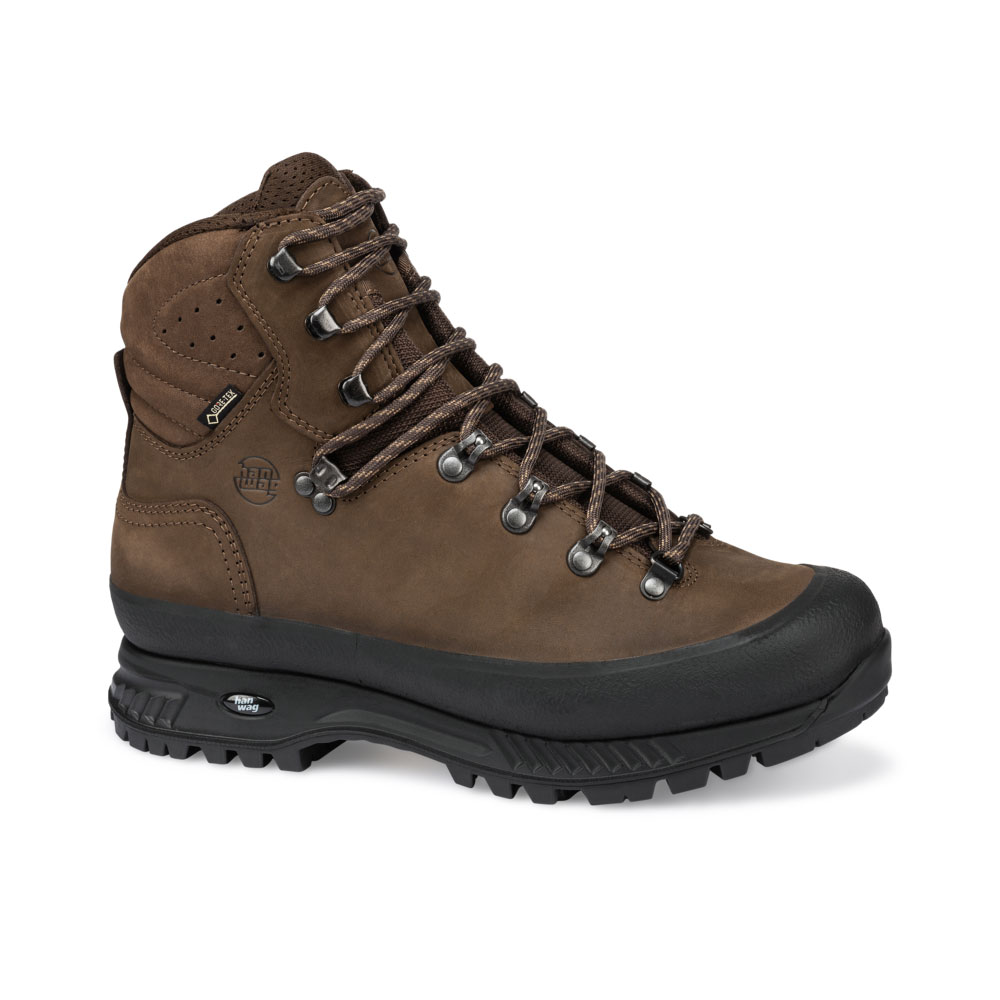
Recommended Footwear
Country: Argentina
Length: 450 km
Stages: 42
Duration: Approx. 6-8 weeks
Terrain: Alpine and subalpine mountain landscapes, desert-like volcanic landscapes
Suitable for: Experienced, adventurous thru-hikers; experienced mountain hikers.
Accommodation: Tent, hostels
Personal requirements: Good level of fitness and solid outdoor skills.
Navigation ability: Very good with map reading, compass and GPS
Info: huellaandinatrail.com
Reading: Lonely Planet Trekking in the Patagonian Andes


Christian Penning
Often found on high-alpine summits, or wild, windy beaches. In the mountains of Bavaria, the Western Alps or South America – mountaineering, trekking and trail running.